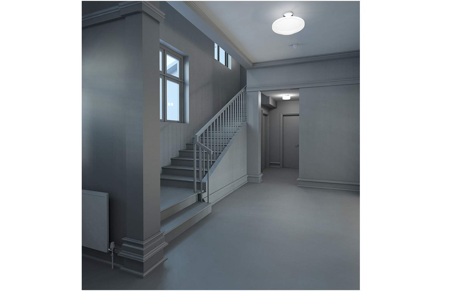
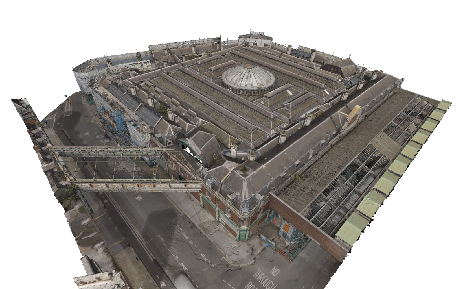
How Platinum 3D Creates Real-World Value from Digital Data

Laser Scanning Scam to BIM Measured Building Surveys

In today’s built environment, accuracy is only part of the story. As laser scanning and BIM technologies have become mainstream, many companies can now capture point clouds and generate 3D models. Yet the real difference lies not just in what is captured, but how that data is interpreted, refined, and shared.

At Platinum 3D Consultants, digital information is transformed into actionable intelligence. By combining measured building surveys, laser scanning, BIM-ready Revit models, and Matterport virtual tours, the company turns raw spatial data into a foundation for collaboration, performance, and long-term value.

This is where precision meets purpose — and where Platinum 3D’s expertise brings measurable real-world benefits for every stakeholder, from architects and developers to facilities managers and estate teams.
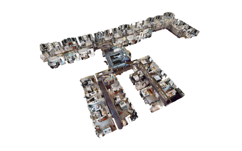
Measured building surveys laser scanning

Why Precision Alone Isn’t Enough Without Interpretation

Laser scanning provides an extraordinary level of detail, capturing millions of points per second to form a precise digital snapshot of a building or site. However, data alone cannot solve problems. Without interpretation, even the most accurate point cloud risks becoming just another file on a hard drive.

That’s why Platinum 3D takes the process further. Every project is supported by specialists who understand both surveying technology and building performance. Instead of handing over raw data, the team creates structured information that’s directly usable in the real world — from 2D floor plans and elevation drawings to intelligent Revit models that support full Building Information Modelling (BIM) workflows.

This blend of technical accuracy and applied knowledge ensures that each deliverable does more than document space — it informs design, planning, and decision-making with confidence.

Turning Scans into Intelligence with In-House Revit Expertise

Where many survey providers stop at data delivery, Platinum 3D continues to add value. Its in-house Revit team transforms point cloud data into BIM-ready 3D models that combine precision geometry with rich information about materials, structures, and services.

This process, often referred to as Scan to BIM, bridges the gap between the physical and digital environments. It allows architects and engineers to work within a coordinated, data-driven model that reflects real-world conditions, helping to identify design clashes, test scenarios, and plan interventions accurately.

Unlike outsourcing or automated conversion services, Platinum 3D’s Revit modellers work closely with surveyors throughout the project lifecycle. The result is an intelligent model that balances technical fidelity with practical usability — ensuring it fits seamlessly into clients’ design and management workflows.

3D digital models from laser scanning

The Synergy Between Measured Surveys, BIM and Virtual Tours

One of Platinum 3D’s key strengths is its ability to integrate multiple technologies into a single, coherent workflow.

  • Measured building surveys establish verified baselines with millimetre-level accuracy.
  • Laser scanning captures the complete geometry of internal and external environments.
  • BIM modelling translates that data into usable, intelligent 3D systems.
  • Matterport virtual tours provide immersive, interactive visualisations for non-technical stakeholders.

Together, these tools eliminate gaps between disciplines. For example, architects can use Revit models for detailed design work, while clients and facilities managers can explore the same space virtually via Matterport. Contractors, planners, and consultants all see consistent, verified information, reducing the risk of misunderstanding or duplication.

This synergy is especially powerful for multi-phase redevelopments, heritage restoration, and large campus sites, where the ability to align visual and geometric data saves both time and money.

Reducing Cost, Carbon and Confusion on Site

Accurate 3D data does more than streamline design — it directly improves sustainability and cost efficiency.

By eliminating guesswork and minimising rework, Platinum 3D’s services help project teams reduce waste and avoid unnecessary site visits. Digital models make it possible to coordinate trades remotely, check design fit, and verify progress against the original conditions, all without the need for constant re-surveying or physical access.

This not only reduces travel and associated emissions, but also shortens project timescales and improves health and safety outcomes. In refurbishment and retrofit projects, particularly where existing conditions are complex or undocumented, laser scanning ensures that every design decision is made with clarity rather than assumption.

The result is smarter resource use, lower carbon impact, and greater confidence across every stage of delivery.

Case Insights: When Integrated Delivery Improves Design Outcomes

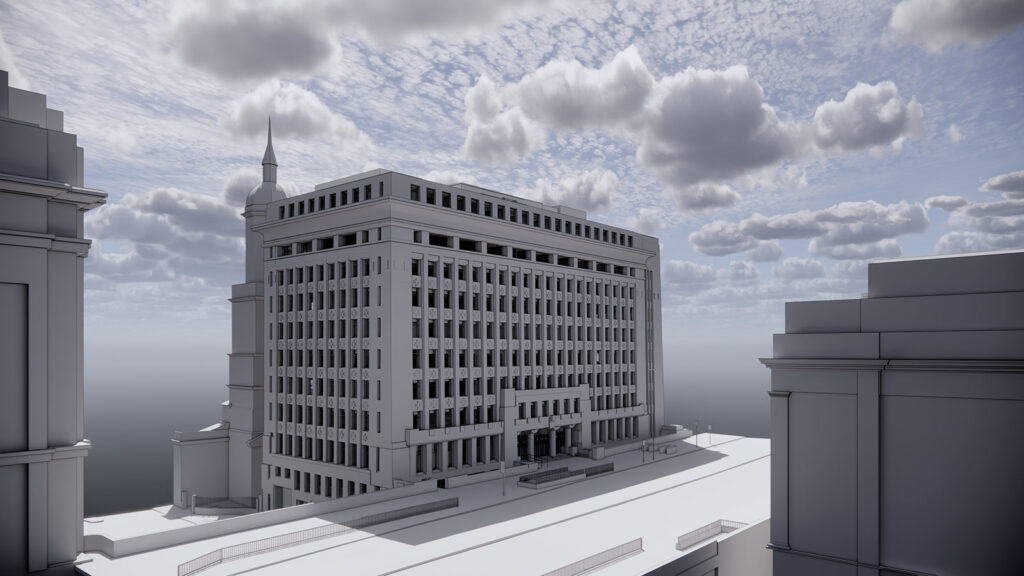
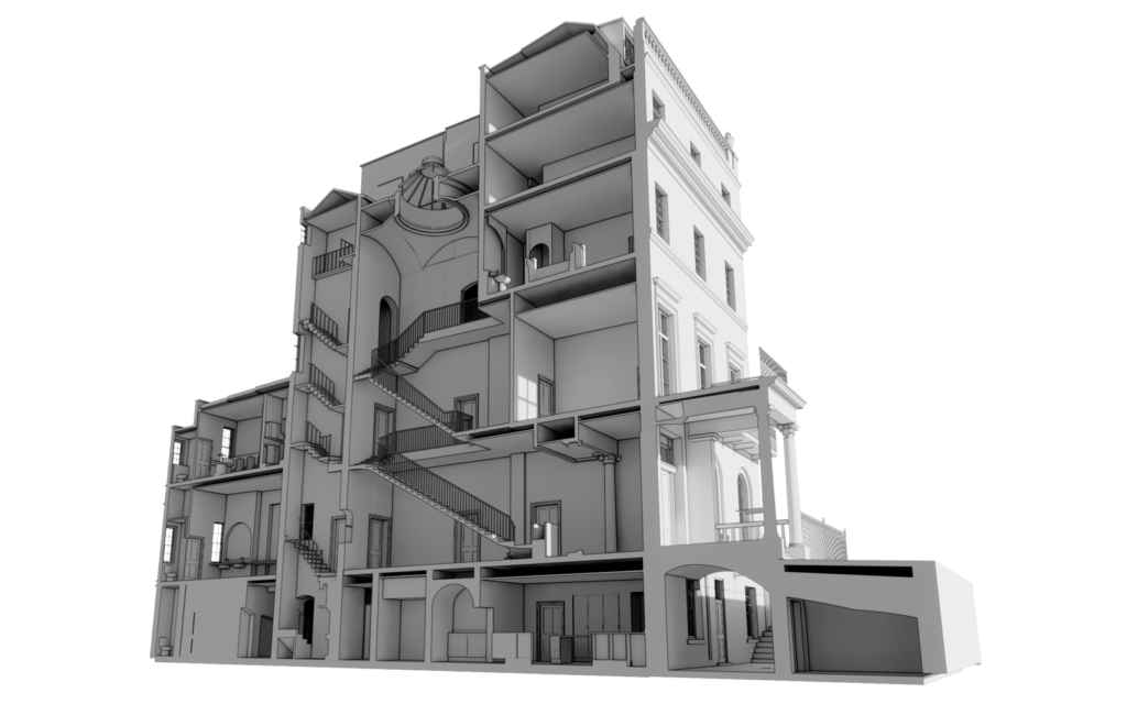
A clear example of this integration in action can be seen at Adelaide House, one of London’s earliest skyscrapers. Platinum 3D’s team carried out a comprehensive laser scan survey and produced an LOD3 Revit model, incorporating the building’s distinctive Crittall windows, tapered walls, and intricate detailing.

Because the model was built on verified point cloud data, the architects were able to plan the restoration of the Grade II listed structure with full confidence in its geometry — ensuring heritage accuracy while modernising its interior for 21st-century use.

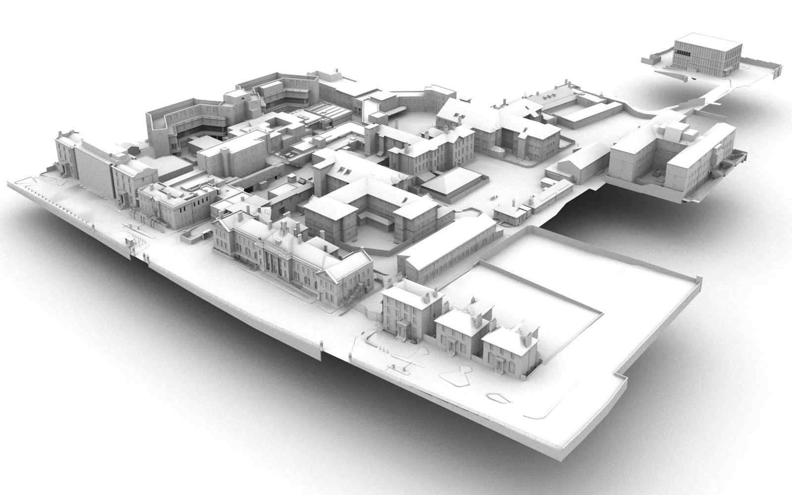
Similarly, at London Metropolitan University, Platinum 3D surveyed 17 buildings to create geo-referenced digital models across the entire estate. This single, consistent dataset now supports both ongoing refurbishment projects and facilities management, giving the university a digital record that evolves with the site.

In both cases, the value went far beyond data capture. The integrated workflow created an enduring resource — one that improves not only design and construction, but also long-term building operation.

Who Benefits from This Integrated Approach

  • Architects and Designers: Gain a precise, editable digital foundation for concept development and coordination.
  • Developers and Project Managers: Use accurate data to de-risk investment and ensure deliverables align with real-world conditions.
  • Contractors: Reduce on-site uncertainty, rework, and delays through verified geometry and digital collaboration.
  • Facilities Managers: Maintain and adapt buildings using a detailed, accessible digital twin.
  • Public Sector and Heritage Clients: Protect valuable assets with measured information that supports conservation and compliance.

Real-World Value, Digitally Delivered

In an era where construction and property decisions rely increasingly on data, Platinum 3D Consultants has built its reputation on transforming precision into purpose. The company’s ability to integrate laser scanning, measured surveys, BIM modelling, and Matterport virtual tours creates not just accuracy, but insight — helping teams make informed decisions that save time, cost, and carbon.

Whether you are managing a listed building, planning a redevelopment, or overseeing a large campus estate, the right data can make all the difference.

Contact Platinum 3D Consultants today to discover how intelligent 3D data can help you plan, design, and manage with greater confidence.
How Our Integrated Services Turn Complex Building Projects into Success Stories

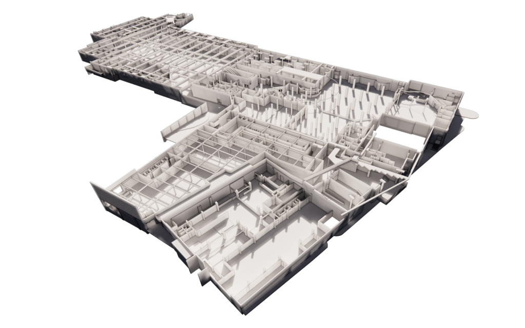
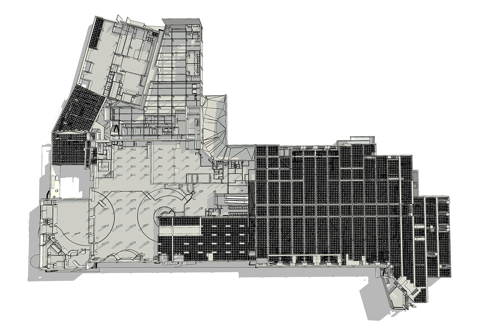
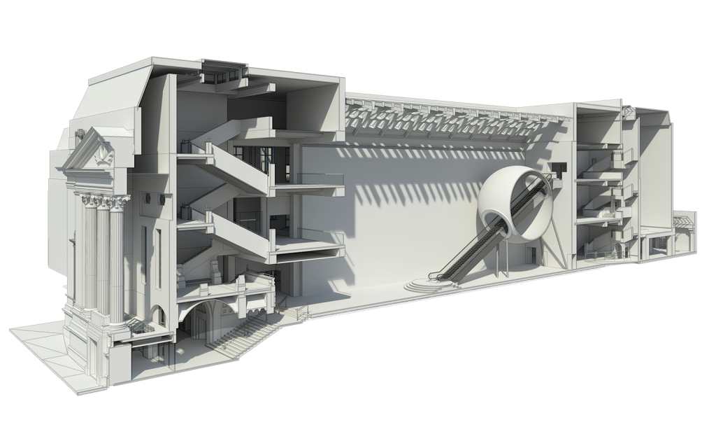
3D model of the basement level Broadwalk Shopping Centre

Every renovation, redevelopment or estate upgrade project begins with one crucial requirement – knowing exactly what already exists. From heritage landmarks and university estates to sports venues and shopping centres, every client faces the same challenge: how to capture, understand and communicate the reality of their built environment.

At Platinum 3D Consultants, that challenge is met with precision, innovation, and over two decades of experience. By combining laser scanning, measured building surveys, BIM-ready Revit models, and geo-referenced datasets, the company provides clients with an accurate digital foundation for confident decision-making, collaboration, and long-term management.

The following projects show how these technologies come together to deliver real-world value across very different types of sites.

Capturing Complexity at the Natural History Museum

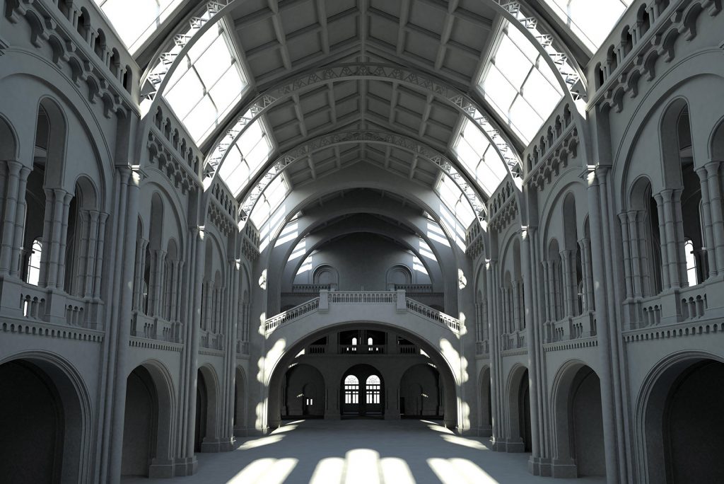
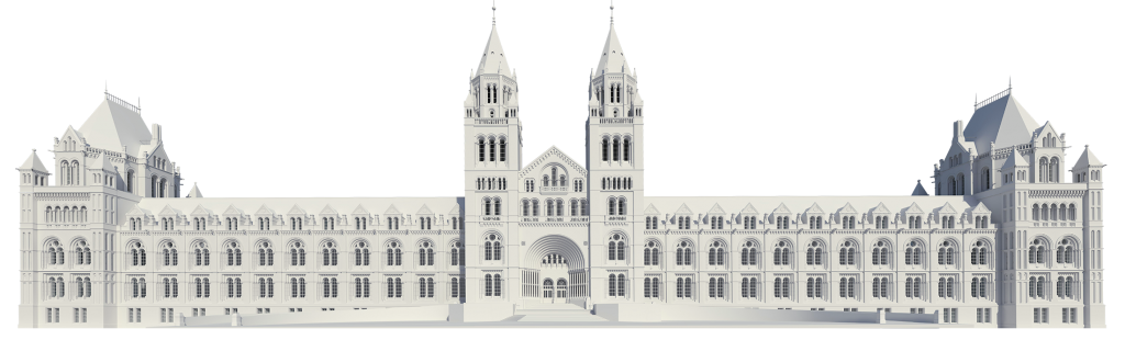
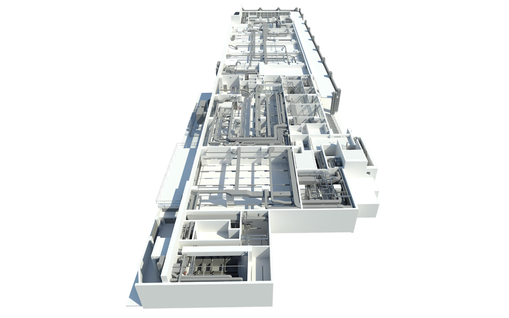
The Natural History Museum in London is not only one of the world’s most recognisable buildings, but also one of the most technically challenging estates to survey. Platinum 3D Consultants carried out a detailed 3D survey and created LOD3 Revit models for multiple areas across the site, including laboratories and plant rooms packed with complex services such as piping, ducting, lighting, switches, and sockets.

By establishing permanent survey control and ensuring every model was geo-referenced within a single coordinate system, Platinum 3D enabled the museum’s teams to link all models into one unified master project. This approach supported the museum’s long-term digital strategy, integrating Building Information Modelling (BIM) as a tool for collaboration, maintenance, and design coordination.

For a client managing a Grade I listed building filled with sensitive scientific infrastructure, that combination of accuracy, accessibility, and digital integration proved essential for sustainable estate management.

natural history museum 3D model

Broadwalk Shopping Centre – Informed Redevelopment from the Ground Up

When developers acquired the Broadwalk Shopping Centre in Bristol, they needed a clear understanding of the existing site before any demolition or redevelopment work could begin. Built in the 1970s, the building had complex additions and sub-levels that required comprehensive documentation.

Platinum 3D Consultants provided a measured survey of the entire site, producing 2D plans of the shopping centre, bingo hall, snooker hall, basement and car park. After seeing the level of precision and coverage provided, the client commissioned a 3D Revit model of the basement area — which was to be partially retained in the new design.

Because the entire site had been laser scanned at the start, the additional model could be created directly from existing point cloud data, avoiding the need for any return visits. This demonstrates how accurate 3D scanning not only saves time and cost, but also gives developers the flexibility to make new decisions confidently throughout a project’s life.

Documenting an Icon – London Stadium

Few structures demand the scale of documentation required for the London Stadium in Stratford. Originally built for the 2012 Olympic Games and now home to West Ham United, the multi-use stadium required comprehensive digital documentation for ongoing redevelopment and facility management.

Platinum 3D deployed the latest Leica RTC360, P20 and P40 scanners, completing over 1,500 scans and capturing more than 12 billion data points. The resulting point cloud data was converted into a Leica LGS file, enabling the client to review and interrogate the 3D environment in Jetstream and TruView.

For a structure of this size and complexity, accuracy and data clarity were critical. The laser scanning process allowed every seat, beam, and walkway to be digitally represented — ensuring that future design, maintenance, and safety upgrades could be planned with confidence and minimal disruption.

Adelaide House – Bringing a Listed Landmark into the Digital Age

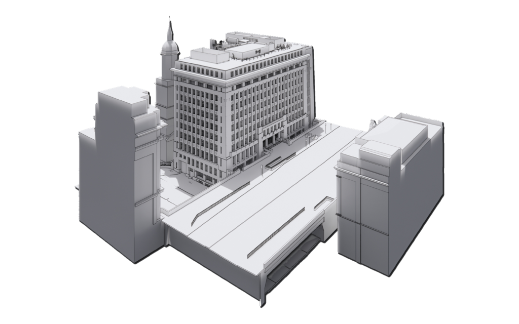
Adelaide House, next to London Bridge, is a Grade II listed building and one of London’s earliest skyscrapers. Its renovation required preserving the historic exterior while updating the interior for modern occupiers — a balance between conservation and innovation.

Platinum 3D conducted a comprehensive laser scan survey, including the building’s lift shafts, service passages, and its connection with London Bridge. The data was processed into an accurate registered point cloud — the foundation for a Scan to BIM workflow.

The company’s modellers created an LOD3 Revit model of the entire building and LOD2 models of surrounding structures for planning context. Unique features such as Crittall windows were modelled using Platinum 3D’s extensive library of parametric families, while the building’s subtly tapered walls were recreated using custom sloped profiles.

This level of precision supports not only the architects and engineers involved in the restoration, but also planning officers and conservation specialists who rely on verifiable, geometrically correct data to approve changes to heritage assets.

Adelaide house laser scan survey Scan to BIM Revit model

London Metropolitan University – A Digital Estate for Smarter Management

At the London Metropolitan University campus in Islington, Platinum 3D carried out a 3D survey of 17 buildings, generating more than 5,000 scans. The survey was completed largely overnight to minimise disruption to students and staff.

Using this data, the in-house team created detailed LOD3 Revit models of each building. Every model was geo-referenced, allowing the entire estate to be connected into a single digital master model.

Working alongside CBRE and the university’s infrastructure and maintenance teams, the models are now being used to support both design and facilities management (FM). Accurate, centralised data is allowing the university to plan upgrades, coordinate refurbishment projects and manage spaces more efficiently — a practical demonstration of how BIM and laser scanning can transform the long-term performance of large estates.

A Connected Process That Delivers Value from Start to Finish

Across all these projects — from museum collections and listed buildings to stadiums, shopping centres and university estates — one thing is clear: the value of integrated digital surveying lies in its versatility.

  • Laser scanning provides fast, non-contact accuracy, capturing every surface and feature.
  • Measured building surveys turn that data into reliable drawings and plans for early design.
  • BIM-ready Revit models enable collaboration, clash detection, and digital asset management.
  • Geo-referencing ensures that all information fits seamlessly into a wider estate context.

By offering this full suite of services, Platinum 3D Consultants removes uncertainty, reduces risk, and creates a common digital language for architects, developers, planners, contractors, and facilities managers alike.

Turning Complexity into Clarity

Whether it’s an intricate heritage restoration, a full campus upgrade, or the redevelopment of an urban site, every project benefits from knowing exactly what’s on the ground before work begins.

Platinum 3D Consultants’ integrated approach — combining 3D laser scanning, measured building surveys, and BIM modelling — transforms that knowledge into a reliable digital foundation for success.

If your next project demands clarity, precision, and collaboration from day one, contact Platinum 3D Consultants to discover how expert 3D data capture can make every decision easier, faster, and more accurate.

Why Cultural and Industrial Sites Need 3D Surveys

3D digital models from laser scanning

Cultural venues like museums and public sector buildings, and industrial facilities such as power rooms, factories, or plant halls, often present some of the toughest surveying challenges. Tight spaces, fragile architecture, hidden services, and safety constraints demand a level of precision and care beyond traditional methods. Measured building surveys using laser scanning, BIM‑ready modelling and immersive virtual tours are essential tools in these settings. At Platinum 3D Consultants we build solutions that satisfy both design and conservation, enabling safe planning, complex upgrades, and reliable facilities management.

3D modelling buildings environments

Cultural and Industrial Environments: What Makes Them Special

Museums, galleries, laboratories, plant rooms and industrial estates differ significantly from simple new-builds. They often have intricate architectural detailing, heritage or listed status, fragile or sensitive finishes, and complex service runs hidden behind walls or ceilings. In industrial settings, machinery, pipework, safety hazards and operational constraints further complicate documenting the true conditions. For these reasons, accurate as‑built data has high value. Without it, projects risk design clash, structural damage, or unexpected cost overruns.

Laser Scanning: Capturing Reality Where It’s Hard to Reach

Laser scanning solves many survey limitations for cultural and industrial sites. It captures millions of data points per second to generate dense point clouds reflecting every surface, pipe, duct, cornice or beam—even where access is limited or parts are confined or fragile. For example, in the Natural History Museum, Platinum 3D performed LOD3 modelling including piping, ducting, lighting, switches and sockets inside laboratories and plant rooms—areas notoriously difficult to capture with traditional measurement methods.

Because laser scanning is non‑contact and can peer into tight or elevated or dangerous zones, it reduces risk to both personnel and the structure. Surveyors avoid delicate surfaces or hazardous areas, yet still capture full context.

BIM‑Ready Models: From Point Clouds to Actionable Design Data

Point clouds are rich, but their value is realised when converted into BIM‑ready Revit models. Level of Detail 3 (LOD3) models include parametric architectural, structural and service elements in precision. They allow architects, engineers, planners and FM teams to explore how new interventions might interact with old fabric—whether that is replacing a historic window frame, upgrading electrical installations, or planning a new plant room layout.

In environments where heritage matters, BIM models help ensure that design proposals respect the original architectural design, listed elements, structural loads, and heritage planning requirements. In industrial contexts, these models support clash detection, machinery fit‑outs, maintenance access, and safety compliance.

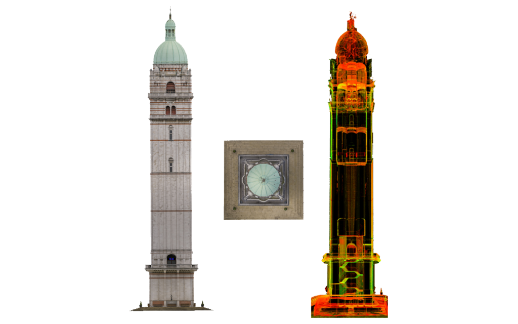
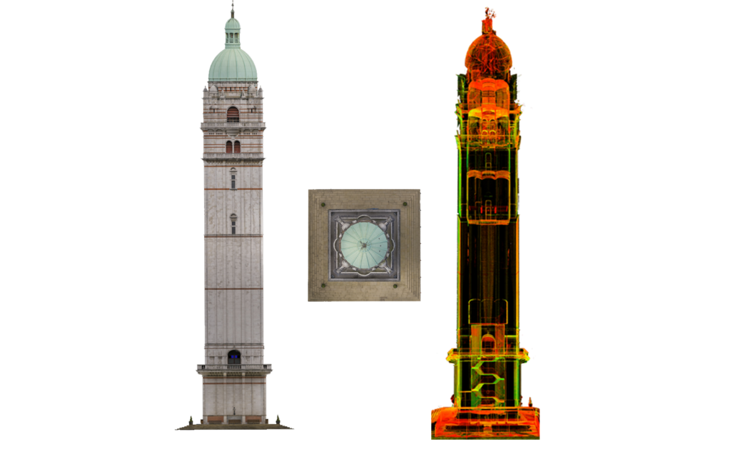
Queens Tower ICL Laser Scan

Matterport Virtual Tours: Visual Clarity for All Stakeholders

Not all stakeholders are experts in reading BIM models or point clouds. This is where Matterport virtual tours excel. These immersive walkthroughs allow trustees, conservation officers, client representatives, operations teams, or marketing departments to visually explore the site in realistic detail. They can see surfaces, finishes, lighting conditions, interventions needed—all before work begins.

Having both a virtual tour and the technical model means everyone has a shared understanding. Design discussions become more grounded; approvals from planning or heritage offices are quicker when decision‑makers can refer to “what it actually looks like now” rather than interpreting aged drawings.

Real‑World Value: Projects Where Precision Made the Difference

One of the strongest examples from Platinum 3D is the Natural History Museum. Here, detailed LOD3 Revit modelling was created from laser scanning including service runs and complex plant rooms. The work was geo‑referenced so multiple parts of the estate could live in the same coordinate system. That means any future survey, design or operational change can slot in without surprises.

In industrial contexts, laser scanning is regularly used to map mechanical halls, large service risers, pipework and infrastructure under tight constraints. Although no public facility case studies for industrial plants are currently detailed on Platinum 3D’s website beyond Natural History Museum, the broader industry reports show that such precision saves time and avoids major downtime by preventing mis‑fits during installation or refurbishment.

Supporting Safety, Compliance, Maintenance and Heritage

For cultural and industrial sites, safety is non‑negotiable. Measured surveys with laser scanning allow teams to plan for maintenance, regulatory inspections, or upgrades with knowledge of existing hazards, without exposing personnel to unnecessary risk.

Compliance with heritage listing or environmental controls often requires proof that the original fabric will be respected. High accuracy modelling supports that, by providing auditable digital records of conditions as they are, which can be preserved long after the building changes. Facilities management teams can then use models and tours to plan maintenance, track deterioration, or manage building systems with clarity.

How Platinum 3D Consultants Deliver Precision & Value

At Platinum 3D we combine the best tools and experience to meet the unique demands of cultural and industrial sites:

  • We start with measured building surveys using high‑performance laser scanners that deliver dense point clouds representing surfaces, structure and services.
  • We geo‑reference the data so all elements align properly across site, plan, and neighbouring structures or estate. This ensures models are accurate in the broader context.
  • Our in‑house team builds BIM‑ready Revit models at LOD3 (for detailed architectural and service elements) and lower LODs where appropriate, depending on project scale and stakeholder needs.
  • Matterport virtual tours are generated to supplement the technical models, giving stakeholders an intuitive visual reference.
  • All deliverables are shared in formats compatible with planning, conservation, FM and contractor workflows.

Talk To Platinum 3D Consultants Today

Cultural and industrial sites require more than good intentions, they demand exactitude. When working with heritage galleries, museums, or complex industrial plant, every detail matters: the alignment of a pipe, the curve of an arch, the access path into a mechanical cupboard. Measured building surveys with laser scanning, LOD3 BIM modelling, and virtual tour capabilities deliver clarity, reduce risk, speed up approvals and preserve legacy.

If you are embarking on a project involving culturally significant architecture or industrial infrastructure, let Platinum 3D Consultants help you ensure precision, respect, and efficiency from day one. Contact us to discover how our 3D surveying tools can support your project safely and intelligently.

How Developers Can Use Measured Surveys to De‑Risk Complex Sites

measured building surveying and laser scanning

Complex sites, e.g., mixed‑use buildings, multi‑building estates, constrained urban plots, or heritage properties, bring many hidden challenges. For developers, uncertainty is one of the biggest risks: unknown site conditions, hidden building fabric changes, legal compliance, unexpected costs. Measured building surveys using laser scanning, BIM‑ready Revit models, geo‑referenced point clouds and Matterport virtual tours are tools that can significantly reduce that risk. At Platinum 3D Consultants we help developers gain clarity from day one, enabling smarter decisions, better bids, more accurate cost projections, and smoother planning and delivery.

Broadwalk Bristol

Why Complex Sites Pose Unique Risks

When a site involves multiple buildings, heritage elements, tight access, or urban constraints, there are many unknowns. Existing drawings may be inaccurate or missing; previous defects or undocumented modifications can be lurking inside walls or ceilings; site constraints (e.g. neighbours, rights of way, party walls, access for plant) may not appear in conventional plans. Environmental risks, structural issues, or services running through difficult‑to‑access places often become expensive surprises. Developers working on urban regeneration, shopping centre redevelopments, or campuses know these issues all too well. A single unforeseen issue can lead to delays, budget overspend, legal challenge or failing to obtain planning or building control approvals in time.

Measured Surveys Give Clarity Before You Buy or Commit

Measured building surveys provide reliable, objective data straight away: a survey of the as‑built condition (using high‑resolution laser scanning) builds a dense point cloud that captures every surface, element, and dimension with millimetre precision. At Platinum 3D we combine that with geo‑referencing, so the scan data is anchored in real‑world coordinates. That means your surveys align with site boundaries, topographical constraints, and neighbouring buildings—important when you’re estimating for demolition, extension, or heritage conservation.

Take the case of the Broadwalk Shopping Centre in Bristol. Platinum 3D surveyed the whole shopping centre, snooker hall, bingo hall, basements and car park. That delivered 2D plans and enabled the developer to understand exactly what needed demolition and what could be retained. Because it was all laser scanned, the client later asked for a 3D model of the basement and loading bay (areas to be retained) without needing another site visit. That saved time and money, and removed risk of misinterpretation. (platinum-3d.com)

BIM‑Ready Models & LOD Levels for Risk Mitigation

Point clouds (the raw data) are hugely useful, but developers benefit even more when that data is turned into BIM‑ready Revit models at sufficient Level of Detail—LOD2, LOD3. Such models include architecture, structure, and often key MEP services. With them you can run clash detection, visualise how new additions or removals will intersect with existing fabric, schedule works with confidence, and predict costs of services relocations or replacements.

For example, in heritage estate upgrades, LOD3 models show you the size and shape of historic windows, the thickness of walls, or the location of original materials—helping satisfy planning constraints and conservation bodies. Such models also feed into long‑term FM (Facilities Management) planning so once built, the site can be maintained, upgraded or adapted with less disruption and fewer unknowns.

Measured building surveys laser scanning

Matterport Virtual Tours: Visual Context & Stakeholder Communication

While technical teams can use BIM models and point clouds, many stakeholders (clients, planners, local councils, community, marketing teams) benefit from visual tools. Matterport virtual tours deliver immersive, photo‑real walkthroughs of existing buildings. They allow viewers to see actual site conditions: layout, lighting, condition of finishes, or even damage. Tours may be tagged with areas needing attention: for example, water damage, corrosion, or planned structural changes.

Developers can use these tours in presentations, planning submissions, or tender packages. For constrained urban sites or heritage buildings where access or visibility is limited, a Matterport tour gives a safe, convenient way for decision‑makers to familiarise themselves with site challenges without being onsite constantly.

Geo‑Referenced Point Clouds: Context, Compliance & Costing

One of the most powerful benefits is geo‑referencing. If your point cloud is aligned with real world coordinates, you can overlay surveys with maps, site boundaries, topography, rights of way and even local authority GIS data. That helps with accurate legal boundary definitions, rights of light analysis, party wall issues, and planning setbacks. It also helps when calculating volumes of demolition or cut/fill in redevelopments, or when assessing site constraints such as utilities or underground services.

Real Estate Redevelopment & Heritage Acquisition Use Cases

Developers acquiring heritage estates, shopping centres, or campuses are among those who most benefit. For example, when redeveloping a mixed‑use site, understanding exactly which parts of buildings are structurally sound, which facades are listed, or which services are non‑compliant—all before acquisition—lets you set realistic costs and timelines. Redevelopment of campuses (e.g. for student accommodation or mixed use), or urban infill projects similarly benefit from reliable data in a congested site where neighbour interfaces, elevation changes, façade sightlines and constraints will affect design.

How Platinum 3D Supports Developers to De‑Risk from Day One

Our approach at Platinum 3D Consultants is tailored to developer needs:
• We begin with a detailed briefing to understand site history, constraints, intended redevelopment scope and stakeholder group.
• We deploy laser scanning to generate accurate point clouds, capture all relevant geometry and service runs, even where access is limited.
• We combine with geo‑referencing so the survey relates to external topography, legal boundaries and digital maps.
• Our in‑house Revit team produces BIM‑ready models at LOD2 or LOD3 depending on project scale, integrating structure, envelope, and services where needed.
• We provide virtual tours via Matterport or similar platforms for visual clarity for non‑technical stakeholders.
• All deliverables are shared in formats compatible with planning, design, FM and costing teams.

The Outcomes: Reduced Risk, Better Decisions, Tighter Budgets

By using measured surveys early, developers can reduce risk of unexpected costs, make informed bids, deliver better planning application submissions, lower chances of planning or regulatory rejection, and reduce overspend from rework. Early detection of clash conflicts, heritage constraints, structural non‑compliance or hidden elements means fewer surprises mid‑build. Confidence in condition, site boundaries, legal constraints and services improves pricing models and financing arrangements.

Talk To Us

In redevelopment or acquisition of complex sites, the difference between success and delay, or between profit and loss, often rests on what you do before you commit to a plan. Measured building surveys using laser scanning, geo‑referenced point clouds, LOD3 BIM models, and visual tools like Matterport tours equip developers to de‑risk early, bid more accurately, plan more confidently, and ultimately deliver more predictably. If you’re a developer facing a mixed‑use, constrained or heritage‑affected site, then bring in Platinum 3D Consultants early.

Let’s talk about how our surveying, modelling and tour tools can help you reduce risk and increase value from Day One.

Not Just a Tour – How Matterport Becomes Your Project’s Visual Anchor

virtual tours of buildings

In construction, refurbishment, and estate development, clarity is paramount—but so is engaging every stakeholder in the project journey. That’s where Matterport virtual tours shine. At Platinum 3D Consultants, we provide immersive 3D walkthroughs that do much more than look impressive—they become your team’s visual anchor, uniting architects, clients, FM managers, planners, and contractors on a single shared view of the building.

Matterport Tours as a Central Reference Point

Matterport virtual tours create immersive, navigable 3D environments that mirror the reality of your project. Stakeholders—whether in the boardroom, on-site, or overseas—can explore the space as if walking through it in person. These virtual tours of buildings serve as a shared digital reference, reducing miscommunication and ensuring everyone is literally on the same page. Viewpoints, elevations, spatial configurations and visual context become instantly accessible without physical disruption to the site.

Scan to BIM

Bridging Visual Tour and Technical Model

While visualisations help with understanding intent and context, technical decisions require accurate geometry and structural insight. That’s why we pair Matterport tours with BIM-ready Revit models built from laser scanning (Scan to BIM). The tour provides spatial awareness and stakeholder engagement, while the corresponding BIM model empowers architects and engineers to perform precise clash detection, coordinate systems, and align design intent with real-world conditions. This dual approach ensures spatial clarity and technical accuracy.

Enhancing Clarity for Non-Technical Stakeholders

Not everyone works with Revit or CAD—and yet all stakeholders must understand the space. Matterport tours offer an intuitive interface for non-technical users. Clients, investors, planners, and contractors can explore site conditions, assess layouts, and focus on features that matter to them. The ability to tag key areas and add notes within the tour provides visual engagement that engages and informs, building trust and speeding approvals in a way that blueprint sheets simply cannot.

A Seamless Process for High-Quality Delivery

At Platinum 3D, we’ve refined our workflow to ensure rapid, consistent, and high-quality Matterport delivery within integrated survey projects:

• We use a high-resolution 360° Matterport camera to capture interior spaces quickly—often within a day.
• Data is processed in the cloud and delivered within 24 hours, with hotspots and context ready for review.
• Our team adds interactive tags, measurements, and context to highlight areas such as mechanical plant, finishings, or intended design changes.
• All content is linked with laser-scan-based BIM models, making it easy to cross-reference spatial walking with exact geometry.

This process offers industry-leading turnaround and clarity that other providers cannot match.

Supporting Every Project Phase

Matterport tours add value at every stage of a project:

Design: Designers use virtual tours to confirm sightlines and spatial relationships before committing to design moves.
Client Briefing: Clients can walk through spaces remotely, eliminating the need for frequent site visits.
Tender and Construction: Contractors access visual context, coordinate workflows, and align installation tasks with fewer questions.
Health and Safety: Inductions into hazardous or occupied spaces can be undertaken virtually, reducing risk and improving readiness.
Facilities Management: Tour files serve as digital twins for building documentation, aiding long-term asset tracking and handover.

vitual building tours Matterport

Real Project Impact

On our project at Cardiff University’s Bute Building, the combination of laser scanning, LOD 3 Revit modelling, and Matterport tours gave both design and estate teams a complete visual and spatial understanding of spaces pre-refurbishment. Teams used the tour to align on design proposals while working within complex, heritage contexts—making updates confidently and reducing onsite guesswork and clashes.

Building Trust Through Visual Reality

Matterport tours don’t just present a view—they invite stakeholders into the space. When viewers can “walk” the building, explore areas, and engage visually before construction begins, they make more informed decisions. This clarity translates to greater buy-in, fewer revisions, and stronger alignment across disciplines.

Why Platinum 3D Is Your Digital Tour Partner

Since 2002, Platinum 3D Consultants have specialised in integrating laser scanning, BIM modelling, and immersive tours into a unified survey workflow. Our all-in-house team ensures consistency, accuracy, and adaptability at every stage—from point cloud capture to the final tour deliverable. We help clients visualise spaces, align teams, and move through projects with confidence.

Talk To Platinum 3D Consultants Today

A virtual tour isn’t just a marketing tool—it’s a foundational asset for your project team. When combined with Scan-to-BIM models, it becomes a powerful visual anchor, aligning perception with precision. At Platinum 3D, we deliver that clarity—quickly, comprehensively, and across your project’s lifecycle.

If you’re ready to make your next project more accessible, coordinated and impactful, let’s talk about how Matterport tours anchored to BIM can transform your process.

When Every Detail Matters – Laser Scanning for Complex and Sensitive Building Restorations

natural history museum 3D building survey

In the world of heritage preservation, every millimetre counts. Intricate mouldings, warped stonework, hidden structural issues—restoring these features demands accuracy beyond the scope of traditional surveying. At Platinum 3D Consultants, our laser scanning services deliver the precision, context, and clarity essential for sensitive restoration works, helping stakeholders make informed decisions while protecting the integrity of historic buildings.

The Unique Challenges of Heritage Restoration

Restoring historic or complex buildings is fraught with challenges. Architectural details may be fragile or inaccessible. Previous renovations may have altered the original fabric. Structural distortions could have occurred over time. Traditional methods like manual measurement or photogrammetry can fall short in capturing these nuances accurately and safely. Mistakes during restoration can mean irreversible damage—not just to the building but to its historical value.

Natural History Museum

Laser Scanning: Non-Invasive Precision

3D laser scanning, or LiDAR, offers a non-contact method to capture highly accurate as-built conditions. It gathers millions of data points per second, producing a dense point cloud that represents both macro geometry and micro detail. This technology allows surveyors to work safely around fragile features, preserving authenticity while ensuring precision.

Capturing Fine Details and Structural Conditions

Historic buildings often have ornate features like carved stonework, vaulted ceilings, or irregular facades. Laser scanning excels at documenting these intricate details in full resolution—whether moulded features, decorative plasterwork, or complex roof geometry. At the same time, it reveals structural issues—such as bowed walls or subsidence—by exposing minute distortions that may go unnoticed by the naked eye.

Combining Laser Scanning with Drones for Complete Coverage

For large or multi-level heritage sites, accessing elevated areas like roofs or spires can be difficult. By integrating drone photography or UAV-based reality capture with ground-based scanning, surveyors achieve comprehensive documentation of both exterior and interior in a single campaign. This combination enhances context, speeds up data collection, and ensures every angle is covered—even from hard-to-reach vantage points.

Transforming Point Clouds into BIM-Ready Models

Raw point clouds are powerful, but their full utility is realised when converted into BIM-ready models. At Platinum 3D, we translate accurate scan data into Level of Detail 3 (LOD3) Revit models. These include parametric architectural elements—such as cornices, mullions, or structural members—enabling architects, engineers, and planners to interact with heritage buildings digitally, assess spatial constraints, and plan sensitive interventions.

natural history museum

Informing Restoration Decisions with Visual Clarity

Preserving heritage isn’t just about measurements—it requires understanding. Our Scan-to-BIM models, enhanced with Matterport virtual tours, provide intuitive, immersive walkthroughs. This visual context helps heritage specialists, planners, clients, and craftspeople collaborate effectively, pinpointing areas for intervention or monitoring without risking on-site wear and tear.

Benefits for Multi-Discipline Stakeholders

Architects can overlay restoration designs with as-built features, ensuring seamless integration with historic fabric. Structural engineers can assess deformations directly from model geometry. Conservation officers can review proposed interventions virtually. All stakeholders work from an accurate, unified dataset—minimising surprises and maximising precision.

A Proven Heritage Example: Natural History Museum

Our work with the Natural History Museum showcases laser scanning’s effectiveness. We created LOD3 Revit models capturing detailed features like piping, ducting, lighting, switches, and sockets within laboratories and plant rooms. These models, geo-referenced and combined with the architectural survey, enabled precise planning and preservation across extensive zones within a heritage context.

Preserving the Past, Planning for the Future

Laser scanning creates a durable digital archive of heritage buildings. In case of damage, reconstruction can rely on verified models. Facilities managers gain access to detailed as-built data for maintenance planning and retrofit works. Academic and educational initiatives benefit from virtual access to historic sites, regardless of physical access restrictions.

When Accuracy Protects Legacy

Restoring heritage buildings requires more than intent—it needs precision. Laser scanning, paired with BIM modelling and immersive visualisation, empowers stakeholders with unrivalled accuracy, context, and collaboration. Platinum 3D Consultants ensure that every detail is respected and every decision informed, helping heritage projects honour their past while planning for the future.

Ready to secure your restoration project with the precision it deserves? Contact Platinum 3D Consultants today to discuss how our laser scanning, BIM and virtual tour solutions can support your heritage restoration from documentation to completion.

Bridging History and Modern Design with High-Accuracy Building Surveys

3D digital models from laser scanning

Heritage and complex refurbishment projects carry layers of historical value and architectural significance. Managing such projects effectively requires precision, care, and comprehensive documentation. At Platinum 3D Consultants, our laser scanning services—combined with BIM-ready Revit modelling—offer exceptional value for stakeholders navigating the delicate balance between preservation and innovation.

Why Heritage Needs Precision

Historical buildings often feature intricate craftsmanship, irregular geometries, and fragile materials. Traditional survey methods can be slow, labour-intensive, and prone to inaccuracies, and they may involve physical contact that risks damage. Even the most experienced surveyors can struggle to capture the subtle curves of vaulted ceilings, the warping of century-old timber, or the fine details of carved stonework using manual methods alone.

3D laser scanning provides a non-invasive, contact-free way to record every detail with millimetre accuracy. This approach ensures the building’s unique features are preserved digitally without any physical interference, giving conservation architects and project teams the exact information they need while protecting the site itself.

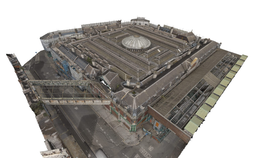
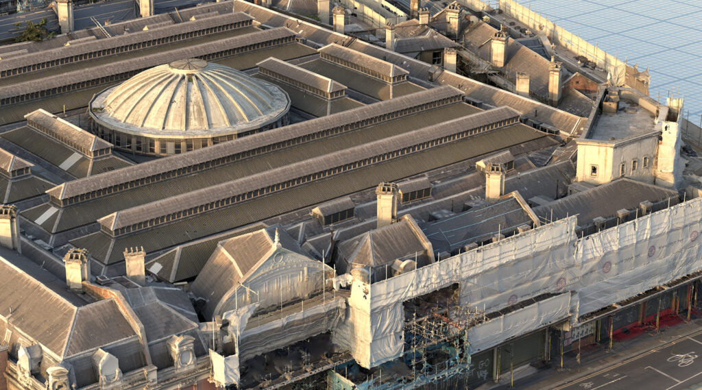
Smithfield Market renovation laser scan survey

Capturing the True Geometry of Time-Worn Structures

Time can leave its mark in ways that are almost invisible until you look closely. Structural settling, material shrinkage, and past repairs often leave a building slightly out of square, with hidden misalignments. Laser scanning generates dense point clouds that capture these subtle deviations with incredible accuracy, from the largest structural spans to the smallest decorative flourishes.

This rich, spatially accurate data forms a precise digital twin of the existing structure. Architects, engineers, and planners can then work with confidence, knowing that their designs are based on the true, as-built geometry—not assumptions or legacy drawings that may be decades out of date. In heritage contexts, this fidelity to reality is essential, as even the smallest error can have a significant impact on authenticity and structural integrity.

Supporting Conservation and Informed Decision-Making

Successful heritage conservation requires balancing modern functionality with historical integrity. Having accurate, verifiable data means design proposals can be assessed against the existing fabric in detail. Architects can ensure that any alterations are sympathetic to the original style, planners can approve work based on factual evidence, and conservation officers can be confident that the project will respect the site’s character.

This level of documentation is also essential for meeting planning conditions, applying for funding, and providing proof of compliance with regulations such as those set out by Historic England or local heritage authorities. For developers and estate managers, it creates a robust, lasting record that can be referenced for decades to come.

Faster Documentation with Minimal Disruption

Working on historic buildings often comes with access restrictions, sensitive environments, or active public use. Prolonged site visits can be disruptive, costly, and even risky for fragile structures. Laser scanning dramatically reduces the amount of time needed on site by capturing comprehensive measurements and visual data in a single, efficient pass.

In many cases, a complete scan can be conducted in hours rather than days. This not only keeps projects on schedule but also reduces physical impact on the building—an important consideration when working with delicate materials or in occupied heritage spaces.

From Scan to Model – Enabling BIM in Heritage Contexts

While point clouds provide exceptional measurement data, their full value is realised when transformed into BIM-ready Revit models. At Platinum 3D, we typically produce LOD3 models for heritage projects, incorporating parametric elements for walls, beams, windows, decorative mouldings, and other architectural features.

These geometrically accurate models allow design teams to simulate interventions, run clash detection, and plan construction phases with a clear understanding of how every detail interacts. For heritage work, this means being able to integrate new systems—such as heating, lighting, or accessibility improvements—without compromising protected features.

Engaging Stakeholders through Visual Context

Not every stakeholder will work directly with BIM data, but most will want to understand the space. This is where our Matterport virtual tours add further value. These immersive, photorealistic walkthroughs enable heritage committees, funding bodies, planners, and the public to experience the building remotely.

By providing both the technical accuracy of a BIM model and the visual accessibility of a virtual tour, Platinum 3D ensures everyone is working from the same understanding, which helps to secure buy-in and support for complex proposals.

Long-Term Stewardship Through Digital Heritage Assets

The benefits of high-accuracy surveys extend well beyond the immediate project. Digital survey data and BIM models become permanent resources for long-term maintenance, monitoring, and management. Estate teams and facilities managers can track changes over time, plan preventative maintenance, and document interventions for future reference.

This digital preservation also offers a safeguard against unexpected events. In the unfortunate event of damage from fire, flooding, or structural failure, the scanned record provides an invaluable reference for restoration efforts.

Platinum 3D’s Role in Heritage and Complex Refurbishment Projects

Our experience in delivering survey-grade laser scanning and BIM modelling for heritage and complex refurbishment schemes means we understand the specialist requirements of these projects. We combine technical expertise with a deep respect for the historical significance of each building, ensuring that our work supports both its preservation and its future use.

By creating an accurate, detailed, and accessible record of heritage assets, we enable stakeholders to make informed, confident decisions at every stage. This approach ensures that the character and value of historic properties are not only retained but celebrated as they are adapted for the future.

Preserving the Past While Planning for the Future

Heritage projects require both sensitivity and precision. By bringing together laser scanning, BIM modelling, and visual engagement tools, Platinum 3D Consultants bridges the gap between history and modern design. The result is a process that respects architectural legacy while delivering the clarity and accuracy needed to plan with confidence.

Ready to protect the character of your heritage project while planning with absolute accuracy? Contact Platinum 3D Consultants today to discuss how our laser scanning and BIM modelling services can support your restoration or refurbishment from start to finish.

Building Smarter Together – Coordinating Multi-Discipline Teams with Laser Scanning

3D digital models from laser scanning

In modern construction and refurbishment projects, collaboration across disciplines is essential—from architects and structural engineers to MEP designers, contractors, and facility managers. However, when teams rely on disparate data sources—outdated drawings, fragmented measurements, and inconsistent documentation—misalignments occur. These misalignments can lead to costly clashes, delays, and rework. Laser scanning offers a powerful solution: it provides a single, accurate model of the existing building that all stakeholders can use. At Platinum 3D Consultants, we help deliver this unified dataset through high-precision laser scanning, Geo-referenced point clouds, and BIM-ready Revit models.

laser scanning 3D building models

The Challenge of Multi-Discipline Coordination

Architects design precise spaces, engineers specify complex services, contractors look at buildability and sequencing, while facility managers focus on lifecycle and maintenance. When decisions are made based on assumptions rather than verified data, small errors—like mispositioned columns or undocumented duct runs—can ripple through the entire project. Miscommunication, mismatched drawings, and incomplete documentation are common root causes of onsite clashes and build delays.

For example, a contractor may order pre-fabricated services based on inaccurate ceiling heights. When installation begins, clashes occur and new parts must be ordered, causing a cascade of cost hikes and timeline slips.

How Laser Scanning Creates One Truth

Laser scanning—also known as LiDAR or reality capture—uses high-precision scanners to capture millions of data points per second. These point clouds represent the real-world geometry of buildings, interior spaces, structures, and services with millimetre accuracy. The resulting dataset acts as a digital twin—serving as the definitive source of truth for every team.

At Platinum 3D Consultants, we perform comprehensive building surveys using advanced Faro or Leica equipment, delivering geo-referenced point clouds that reflect existing conditions precisely. With that, architects, engineers and contractors can all work from the same foundation.

scan to BIM

From Point Clouds to BIM-Ready Revit Models

Raw point clouds are useful, but intelligent project coordination requires models. Our in-house Revit modelling team transforms 3D scans into BIM-ready Revit models at LOD2 or LOD3. This includes parametric walls, beams, openings, MEP services, and more, all aligned with the as-built point cloud.

With this model:

  • Architects can design expansions or upgrades confidently.
  • Structural engineers verify clearance zones.
  • MEP designers can route services without interference.
  • Contractors can plan build sequence and prefabrication.
  • FM teams inherit a future-proof maintenance asset.

All stakeholders operate from one, shared digital source—minimising misinterpretation and enhancing collaboration.

Real-Time Clash Detection and Collaboration

With multi-discipline Revit models, teams can run clash detection using tools like Navisworks or Revit itself. Common issues such as conflicting duct or pipe runs, structural obstructions, or access conflicts can be flagged and resolved early—long before they impact site delivery.

At Platinum 3D, we’ve seen how early clash detection reduces site rework by up to 40%, significantly impacting timelines and budgets. Coordination workshops, conducted using shared models and virtual insights, become more effective—consultants, architects, and contractors collaborate in a single virtual space.

Improved Planning Across Complex Estates

This approach scales across multiple buildings or campuses. For instance, working on a university with 17 separate buildings requires high levels of coordination. Platinum 3D creates geo-referenced, linked BIM models that enable landscape, access, and infrastructure planning across the entire estate. Utility routes, pedestrian flow, and phased works can all be visualised and coordinated between buildings using a single digital platform.

Estate teams, developers, and planners benefit from holistic views and reliable data—supporting strategic decision-making at scale.

Bridging the Gap with Virtual Tours

Laser scanning and BIM models are potent, but visual context matters too—especially for non-technical stakeholders. Matterport virtual tours bridge the gap, offering immersive access to the building via a 360° walkthrough. These virtual tours—created from the same point clouds—help stakeholders visually interpret space, circulation and features before design decisions are made.

For example, investors or tenant representatives can tour a leased space virtually, and add feedback directly. This visual clarity fosters a unified understanding across teams, enhancing alignment from early stages through to sign-off and handover.

Lifecycle Value for Facilities Management

Coordination doesn’t stop when construction ends. Facility managers inherit precision models that reflect the as-built condition. With this data, they can manage future refurbishment, maintenance planning, compliance tracking, and asset lifecycle management with confidence. Having accurate geometry and metadata from day one prevents misinterpretations and preserves institutional knowledge.

Why Platinum 3D Is Your Strategic Partner

At Platinum 3D Consultants, we’ve been delivering Scan-to-BIM services since 2006, with extensive experience in laser scanning survey, BIM modelling, and integrated digital deliverables. As a single-source provider, we deliver scanning, Revit modelling, and virtual tours with in-house capability—ensuring consistency, accuracy, and adaptable coordination throughout your project.

Our approach ensures every stakeholder—from architects to FM—is empowered by intuitive, accurate information. No assumptions. No hidden data. Just clarity.

When Everyone Sees the Same Thing, Projects Run Smoothly

At its core, effective multi-disciplinary coordination hinges on shared understanding. By transforming physical spaces into precise digital models and immersive virtual tours, Platinum 3D Consultants equip every stakeholder with the tools they need to collaborate, decide and deliver—accurately and efficiently. Whether refurbishing a single interior or reimagining an entire campus, precision and visibility drive success. Build smarter by working together—and start from a place of shared clarity.

Contact us today to see how our laser scanning, BIM-ready modelling and virtual tour services can unite your project team and keep your project on point.

Why Virtual Tours Are Now Essential for Project Buy-In Beyond the Site Visit

Scan to BIM

In construction, refurbishment and estate development, decisions rarely hinge on design alone. Stakeholders need to understand a space—its layout, its constraints, its possibilities. But traditional site visits can be logistically challenging, costly and sometimes impossible. This is where virtual tours, particularly those created with Matterport technology, are transforming the game. At Platinum 3D Consultants, we’ve seen first-hand how 3D virtual tours now play a pivotal role in securing buy-in, improving communication, and streamlining decision-making from day one.

Bringing the Site to the Stakeholders

Whether it’s a university estates team, a remote architect, or an international investor, not every decision-maker can make it to site. Matterport virtual tours remove that barrier. Captured using a 360-degree camera and processed quickly, these tours allow anyone to step into a building virtually and explore it at their own pace—without travel or scheduling headaches.

For example, when KI Europe wanted to showcase their London showroom to clients across Europe and beyond, Platinum 3D created a virtual tour in under a day. This digital walkthrough was then enriched with interactive tags that provided furniture specifications and links—turning it into a self-guided sales tool accessible 24/7. What began as a visualisation aid became a powerful marketing asset that improved both reach and engagement.

3D modelling buildings environments

Better Decisions Start With Shared Understanding

In early project phases, assumptions based on out-of-date plans or flat images can cause delays, design errors and unnecessary risk. A Matterport tour gives everyone—from client to contractor—a clear, up-to-date understanding of the building’s layout and condition. This visual “source of truth” means fewer miscommunications, faster design feedback, and more confident planning.

Virtual tours also enhance early-stage design by helping architects and consultants identify key features or constraints—whether it’s understanding spatial relationships in listed buildings, or planning MEP layouts in tight ceiling voids. When combined with our laser scanning and Revit modelling services, the tour becomes part of a fully coordinated digital toolkit.

Supporting Planning and Conservation Requirements

Planning officers and conservation stakeholders increasingly welcome digital tools that improve transparency and reduce administrative friction. A high-quality virtual tour can illustrate conditions more clearly than a written report—especially when paired with measured survey data and BIM outputs. In historic or sensitive buildings, Matterport allows planning teams to explore areas that may be difficult or dangerous to access in person, such as roof voids or sub-basements.

This approach can also support listing applications, Section 106 agreements, and design-and-access statements. For refurbishment projects, where preserving key architectural features is essential, a virtual tour makes it easier to demonstrate the impact—or lack thereof—of proposed changes.

A Practical Tool for Health, Safety and FM

Virtual tours of building and environments don’t stop being useful once planning is secured. During construction and post-completion, they’re an invaluable tool for Health & Safety inductions, contractor coordination, and Facilities Management handovers. By tagging key building systems—plant rooms, service risers, fire escapes—Platinum 3D’s clients use Matterport tours to orient new staff or contractors before they ever set foot on site.

This is especially helpful on large or high-risk sites, where physical access may be limited. Site managers can highlight hazards in advance, monitor restricted areas, or even use the tour as part of emergency planning documentation.

Laser Scanning Buildings BIM Revit Models Matterport

Remote Collaboration and Reduced Carbon Footprint

In an era of hybrid working and ESG commitments, virtual tours contribute to more sustainable project delivery. Clients, consultants and contractors can meet online and walk through the tour together—eliminating the need for multiple carbon-intensive site visits. This helps reduce travel, save time, and limit environmental impact.

For example, on multi-phase campus redevelopments or long-term estate upgrades, Matterport can be used to benchmark progress, document handover conditions, and allow ongoing visibility for stakeholders who aren’t physically present.

Marketing and Sales Gains for Developers and Landlords

Beyond construction, virtual tours are also a commercial asset. Developers, housing associations and landlords can use them to showcase existing stock or pre-lease refurbished spaces. With smart tagging, they can link to floorplans, finishes, materials and product details—turning the tour into an interactive digital brochure.

One property client we worked with used their Matterport tour to speed up decision-making during office fit-outs. Clients could “walk the floor”, choose finishes and review spatial options before signing off—all remotely. This reduced the design iteration process and significantly shortened time-to-let.

A Seamless Part of the Platinum 3D Workflow

At Platinum 3D Consultants, virtual tours are not an isolated offering—they’re a seamless part of our full-service workflow. A laser scan captures the geometry. A BIM-ready Revit model delivers design intelligence. A Matterport tour provides intuitive visual context. All three are generated from the same site visit—saving time, maximising value, and reducing disruption.

Because our surveyors, modellers and tour specialists work as one team, clients receive consistent, high-quality outputs that speak to every stakeholder—from designer to director.

Seeing Is Believing—and Delivering

In complex construction and refurbishment projects, success often depends on one thing: getting everyone on the same page early. Matterport virtual tours enable that by making the site visible, explorable, and understandable for everyone—wherever they are. Whether you’re building consensus across teams or showcasing your project to a wider audience, this tool helps you do it faster, smarter and with more impact.

If you’re ready to improve project clarity, accelerate buy-in and reduce costly surprises, Platinum 3D can deliver the precision tools to get you there. From laser scanning and BIM modelling to full Matterport tours, we turn real spaces into clear opportunities.

Why ‘Good Enough’ Isn’t Enough: The Hidden Cost of Inaccurate Site Data

3D modelling buildings environments

Explore how legacy drawings and rough measurements introduce hidden cost risk—and how Platinum 3D Consultants use survey‑grade laser scanning and scan‑to‑BIM modelling to eliminate these from the outset.

When your project starts with assumptions, not precision, the consequences can be expensive. A few millimetres out on a drawing may seem trivial—but that tiny error can trigger clashes between structural elements, unexpected onsite modifications, wasted materials, and costly delays. The construction industry estimates that rework caused by inaccurate site information can add up to 30–40 per cent to project budgets. To avoid these pitfalls, survey‑grade laser scanning and BIM modelling by Platinum 3D Consultants deliver clarity, accuracy and confidence from the very beginning.

measured building surveying and laser scanning

Legacy Data Can Be A Risky Foundation

Many projects still launch based on dated drawings, handwritten sketches, or rough manual measurements. Historical records often lack updates made over decades, and undocumented modifications can surprise teams when refurbishment work begins. Relying on this outdated content is like navigating blindfolded.

At Platinum 3D Consultants, we’ve seen projects restarted mid-phase because walls didn’t line up, services clashed unexpectedly, or site geometry simply didn’t match the design intention. A mistake as small as a misaligned duct or misrecorded window opening can ripple through a project, causing friction between architects, engineers and contractors.

What Makes a Survey Truly “Survey‑Grade”?

Our process begins with a measured building survey using high‑precision laser scanners—typically Leica or FARO hardware—that capture up to a million data points per second. These devices create a dense, millimetre‑accurate point cloud, capturing every surface, angle, and nuance of the built environment.

This registered point cloud is then aligned with established control networks or geospatial references, ensuring that every scan ties accurately to real‑world coordinates. Unlike approximate sketches or manual tapes, this data provides an absolute record of the as‑built conditions—foundations, walls, services, apertures and hidden duct runs included.

Transforming Data into Actionable BIM Models

Platinum 3D’s in‑house Revit specialists convert point cloud data into BIM‑ready models at the appropriate Level of Detail (LOD2 or LOD3). These models are geometrically correct and embedded with parametric elements, metadata, and structured naming conventions for easy integration into design and project workflows.

Architects gain confidence designing from an accurate base; engineers can perform clash detection early; contractors can prefabricate with assurance; and facility managers later rely on the model for long‑term maintenance planning. Every stakeholder works from the same digital foundation—eliminating discrepancies that can slow progress or increase cost.

Building Measurement 3D Modelling Laser Scanning

Real‑World Repercussions of Poor Data

Consider the simple scenario of a renovation project utilising outdated floor plans. An architect might assume a corridor width that actually varies on site. When prefabricated wall systems arrive, they don’t fit, prompting redesign and delay. Or imagine a contractor working off an old drawing where a ceiling void contains hidden structural steel—leading to rework that stalls the schedule and increases labour costs.

The data platform research community consistently finds that visual clash detection and data verification using scan‑derived BIM models reduces rework and avoids up to 40 per cent of avoidable onsite fixes. In contrast, manual assumptions often mask these risks until they become physical problems.

Improved Collaboration and Communication

Using a unified BIM model transforms multi‑stakeholder projects. Platinum 3D’s survey‑grade data supports Revit, Navisworks and other platforms, allowing project teams to run coordination reviews digitally before work ever begins. Project meetings shift from guesswork to data verification, helping reduce RFIs and alignment requests.

As shared digital models become the source of truth, architects, engineers, contractors and FM teams coordinate more smoothly—saving time, money and avoiding post‑handover complications.

Value Beyond the Construction Phase

Once the model is built, its value extends far beyond design. Facilities management teams benefit from access to accurate details—plant locations, service corridors, maintenance zones and health & safety routes all become part of the digital record.

At Royal Gwent Hospital, for example, Platinum 3D delivered BIM‑ready Revit models from scan surveys across multiple departments. Architects used the models for design and refurbishment planning, while FM teams now leverage the same datasets to coordinate maintenance and lifecycle activities—without that nagging risk of mismatch between drawings and reality.

Why Choose Platinum 3D Consultants?

Platinum 3D Consultants have specialised in laser scanning, measured building surveys and scan‑to‑BIM modelling since 2002, and have been producing BIM‑ready deliverables consistently since 2006. Our team operates entirely in‑house—no outsourcing—ensuring high quality and consistent standards. We are experts in defining the correct level of detail, producing precise parametric models and guiding clients through the implementation process.

Our workflow is transparent and client‑orientated: we establish control networks, register point clouds to UK standards (e.g. RICS and IPMS), provide clear level‑of‑detail guides, and remain available throughout the project as needs evolve.

Start with Data You Can Trust

Projects rooted in assumption are vulnerable to costly surprises. Platinum 3D Consultants bring survey‑grade precision to the start of your design process—catching potential issues before they cost time and budget.

From millimetre‑accurate laser scan data to structured scan‑to‑BIM modelling, our services help developers, architects, contractors and facilities teams build smarter, coordinate better and deliver more reliable projects.

If you’re starting a refurbishment, retro‑fit, redevelopment or adaptive reuse project, don’t begin with outdated drawings—build on precision instead. Get in touch with Platinum 3D Consultants today and ensure your plans are built on real data, not guesswork.