How Measured Building Surveys Inform the Demolition and Redevelopment Process

Broadwalk Bristol

Demolition and redevelopment projects are complex undertakings that require meticulous planning to ensure success. From assessing existing conditions to preparing for construction, having accurate and comprehensive building data is crucial. Measured building surveys, powered by cutting-edge laser scanning technology, play a vital role in informing and streamlining these processes.

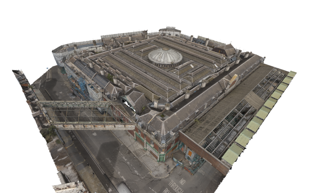
At Platinum 3D Consultants, we specialise in delivering high-precision measured surveys and creating detailed 2D plans and 3D BIM-ready models. This blog will explore how  measured surveys contribute to demolition and redevelopment projects, using the Broadwalk Shopping Centre in Bristol as a real-world example, and explain the value and benefits they bring.
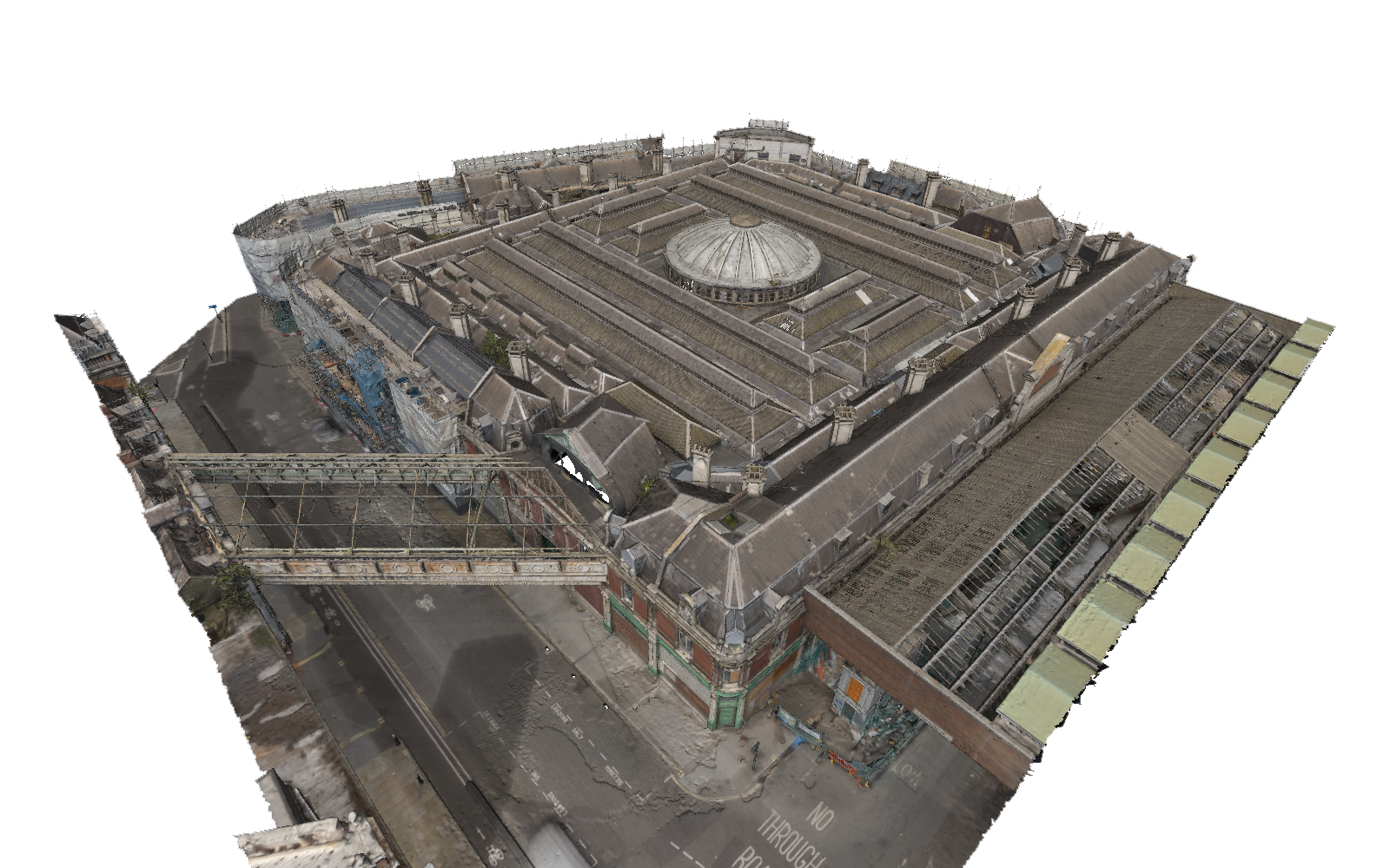
Broadwalk Bristol

A Case Study: Broadwalk Shopping Centre, Bristol

The Broadwalk Shopping Centre in Bristol, built in the 1970s, was earmarked for demolition and redevelopment following its closure in 2017. The redevelopment plan includes replacing the shopping centre with a mixed-use community hub, incorporating additional housing to address local needs.

Platinum 3D Consultants provided a comprehensive measured building survey of the entire site, including:

  • The shopping centre.
  • A snooker hall.
  • A bingo hall.
  • Basements.
  • The car park.

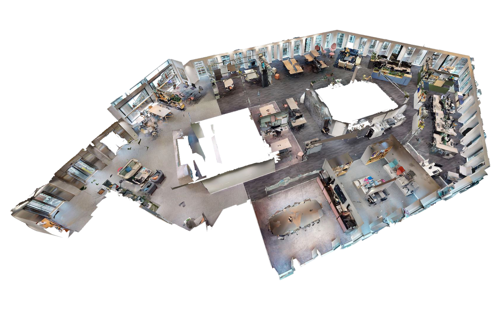
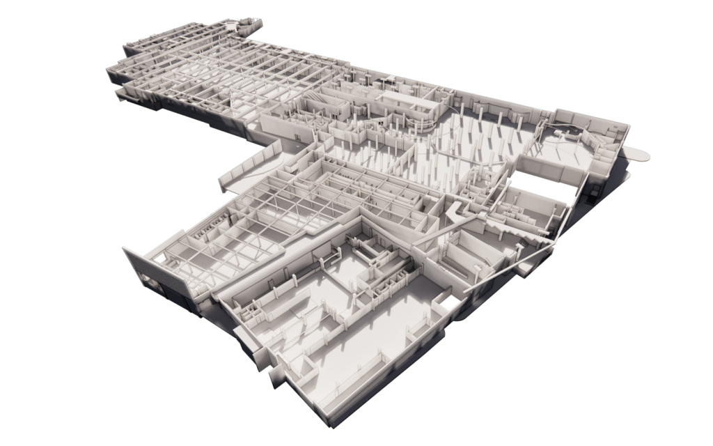
Initially, detailed 2D plans were delivered to the client to assist with demolition planning. Later, a 3D Revit model of the basement and loading bay was requested, as these areas were to be partially retained in the new development. Since the entire site had already been laser scanned, the additional model was created without requiring a return site visit—a prime example of how measured surveys add long-term value.

The Role of Measured Surveys in Demolition and Redevelopment

1. Accurate Documentation of Existing Conditions

Before any demolition begins, understanding the current state of a building or site is essential. Measured surveys provide highly detailed and accurate data about the layout, dimensions, and structural features of the existing environment.

  • How It Helps:
    Accurate documentation ensures that demolition teams are fully informed about what they’re working with, reducing the risk of unexpected issues during demolition.
  • Platinum 3D’s Expertise:
    Our laser scanning technology captures every detail with millimetre precision, producing data-rich outputs such as 2D floor plans, elevations, and sections.

2. Identifying Structural Features for Retention

In redevelopment projects, certain parts of a building or site may need to be retained for heritage, structural, or functional reasons. Measured surveys help identify and document these features with precision.

  • Broadwalk Example:
    The basement and loading bay of the Broadwalk Shopping Centre were to be partially retained. The 3D Revit model created by Platinum 3D ensured that these elements were accurately documented for integration into the new development.
  • How It Helps:
    Ensures seamless integration of retained structures with new designs, reducing delays and errors during redevelopment.

3. Supporting Demolition Planning

Demolition is a risky and complex process. Without accurate data, teams risk damaging structures that are meant to be preserved, or encountering unexpected complications on-site. Measured surveys mitigate these risks by providing detailed and reliable plans.

  • How It Helps:
    • Guides the sequencing of demolition.
    • Identifies load-bearing elements and other critical structural components.
    • Ensures safety and compliance with regulations.
  • Platinum 3D’s Contribution:
    Our geo-referenced surveys enable precise spatial understanding, ensuring that every detail is accounted for in demolition plans.

4. Enhancing Collaboration Among Stakeholders

Redevelopment projects involve multiple stakeholders, from architects and engineers to contractors and project managers. Measured surveys provide a single, accurate source of truth for all teams.

  • How It Helps:
    • Facilitates better communication and coordination.
    • Ensures all parties are working with the same accurate data.
    • Reduces the risk of miscommunication and rework.
  • Platinum 3D’s Deliverables:
    Our BIM-ready models allow stakeholders to collaborate effectively, providing a shared platform for design and execution.

5. Future-Proofing the Redevelopment Process

The data collected through laser scanning is not only valuable for demolition but also for the entire redevelopment lifecycle. Detailed surveys and models can be revisited and adapted as project requirements evolve.

  • Broadwalk Example:
    The initial survey data collected by Platinum 3D was later used to create a 3D model of the basement without requiring a return to the site, saving time and resources.
  • How It Helps:
    • Reduces the need for repeat site visits.
    • Provides a flexible resource for future planning and maintenance.
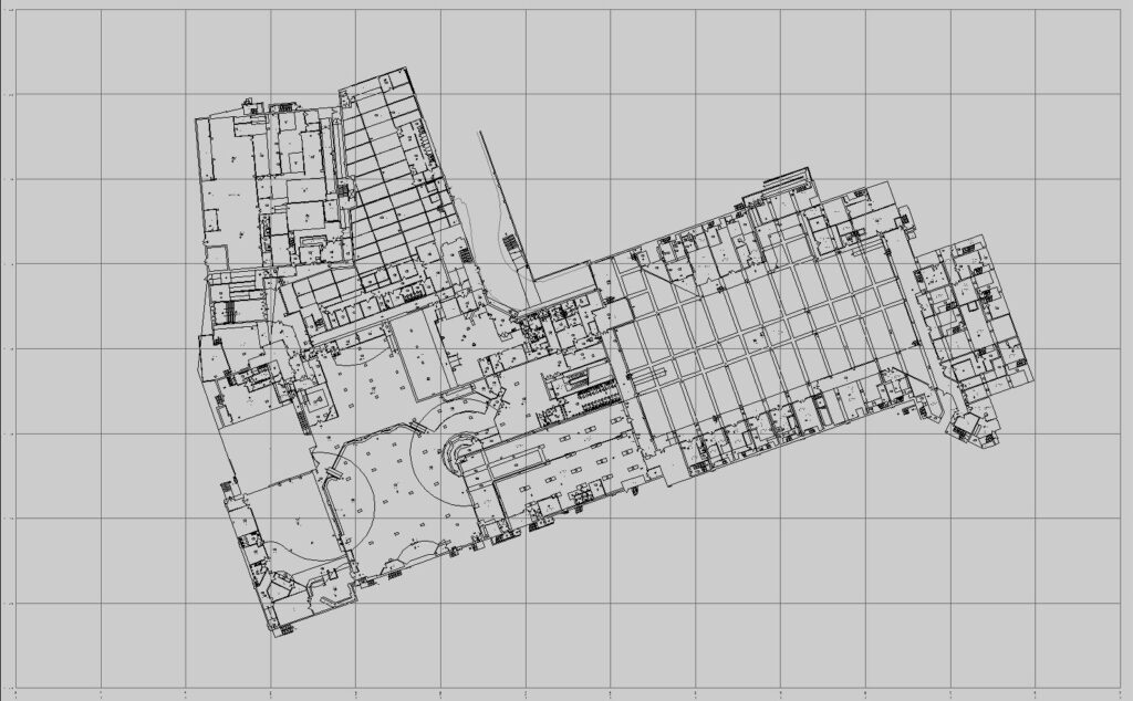
Broadwalk basement level

Benefits of Using Measured Surveys in Demolition and Redevelopment

  1. Precision and Accuracy:
    Laser scanning ensures that all measurements and features are captured with millimetre accuracy, reducing uncertainty.
  2. Time and Cost Efficiency:
    Comprehensive data reduces delays and prevents costly mistakes during demolition and redevelopment.
  3. Safety Assurance:
    Detailed surveys enable careful planning, minimising risks to workers and surrounding structures during demolition.
  4. Informed Decision-Making:
    Stakeholders have access to reliable data, enabling smarter, data-driven decisions throughout the project.
  5. Sustainability:
    Retaining and reusing parts of existing structures reduces waste and supports sustainable construction practices.

Why Choose Platinum 3D Consultants?

At Platinum 3D Consultants, we combine advanced technology with industry expertise to deliver tailored solutions for demolition and redevelopment projects. Our services include:

  • Laser Scanning: Capturing highly accurate data with millimetre precision.
  • Measured Building Surveys: Delivering 2D plans, elevations, and sections to guide demolition and redevelopment.
  • Scan to BIM: Creating 3D Revit models that integrate seamlessly into design and construction workflows.
  • Geo-Referenced Data: Ensuring all plans and models align within a unified coordinate system.

We’ve worked on projects of all sizes, from historic buildings to large commercial developments, always prioritising precision, efficiency, and client satisfaction.

Talk To Us

Measured building surveys are an essential tool for any demolition and redevelopment project, providing the accuracy and insight needed to navigate these complex processes with confidence. By documenting existing conditions, supporting safe demolition, and facilitating collaborative workflows, surveys ensure that projects proceed smoothly and successfully.

If you’re planning a demolition or redevelopment project, contact Platinum 3D Consultants today. With our expertise in laser scanning, measured surveys, and 3D modelling, we’ll provide the precise data you need to achieve your goals efficiently and effectively. Let’s transform your vision into reality!
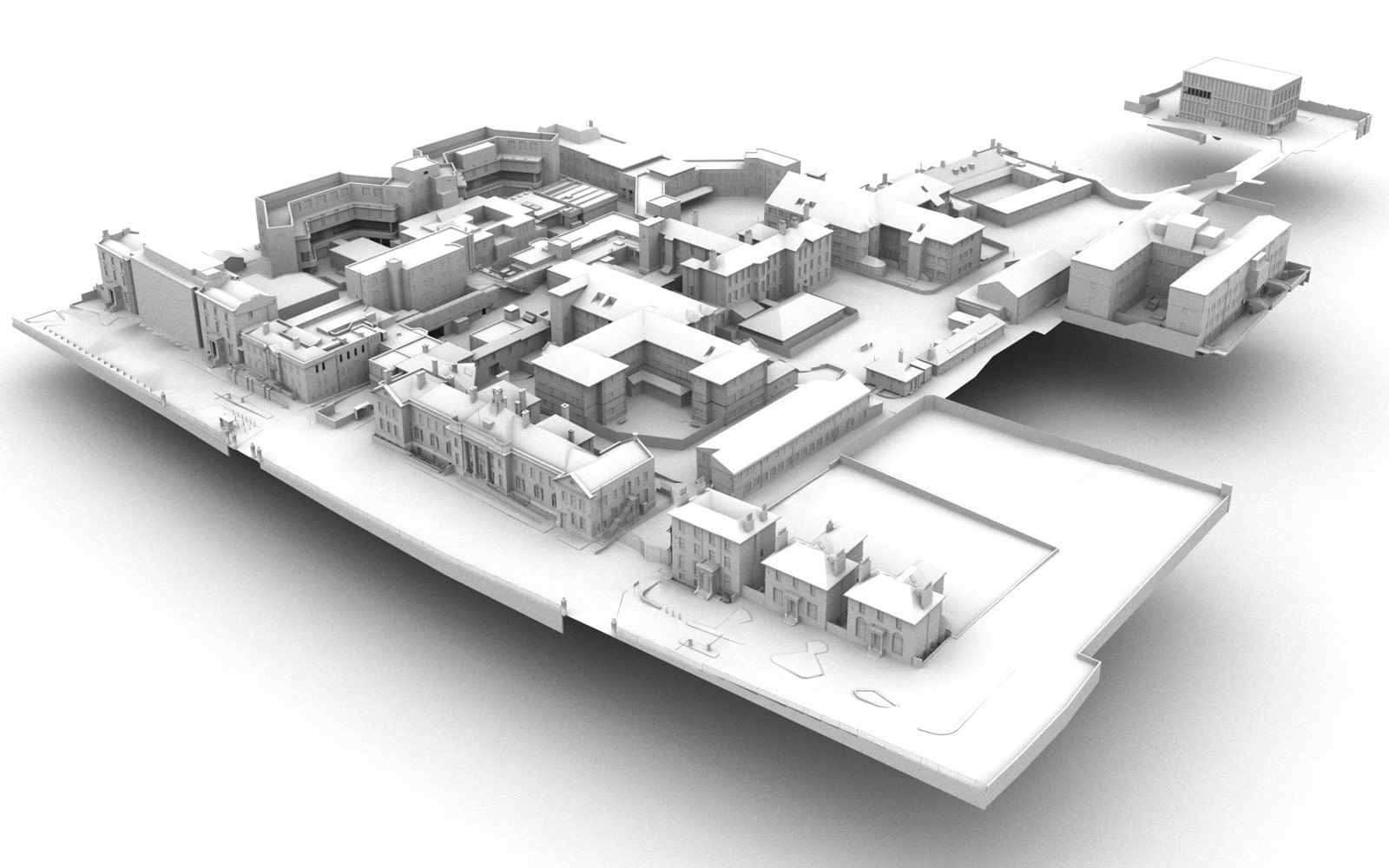
FAQs About Measured Building Surveys – Popular Questions Answered

measured building surveying and laser scanning

When embarking on a project involving renovations, facility management, or new construction, understanding the role and value of Measured Building Surveys can make all the difference. These surveys provide the critical data needed for informed decision-making, accurate designs, and efficient project execution.

At Platinum 3D Consultants, we specialise in measuring and modelling the built environment using state-of-the-art reality capture technology. From creating precise 3D digital models to providing BIM-ready deliverables, we ensure every project is built on a foundation of accuracy.

This blog addresses some of the most frequently asked questions about measured building surveys, helping those with little or no prior knowledge understand their purpose, process, and benefits.

3D digital models from laser scanning

1. What Is a Measured Building Survey?

A Measured Building Survey is a detailed and precise documentation of a building’s physical layout and features. It captures structural elements like walls, floors, windows, and doors, as well as services like plumbing, electrical, and HVAC systems, depending on the level of detail required.

Platinum 3D’s Approach:

We use laser scanning technology to capture millions of data points, generating a highly accurate point cloud. This data is processed to produce floor plans, elevations, sections, or even full 3D BIM-ready models tailored to your needs.

2. Who Needs a Measured Building Survey?

Measured building surveys are invaluable for a wide range of professionals and projects, including:

  • Architects: To design renovations or extensions with confidence.
  • Engineers: For structural assessments or retrofitting existing buildings.
  • Facility Managers: To streamline maintenance and space utilisation.
  • Property Developers: To ensure accurate area referencing and compliance.
  • Heritage Preservationists: To document and restore historic buildings.

3. What Technology Is Used for a Measured Building Survey?

The cornerstone of modern measured building surveys is laser scanning technology. Using LiDAR (Light Detection and Ranging), laser scanners emit beams of light to capture precise measurements of surfaces, creating a 3D digital representation of the building.

Why Laser Scanning?

  • Accuracy: Achieving millimetre precision.
  • Efficiency: Captures large volumes of data quickly.
  • Non-Invasive: Ideal for fragile or hard-to-reach structures.

At Platinum 3D Consultants, we combine laser scanning with Scan to BIM technology, enabling us to convert point cloud data into BIM-ready Revit models for seamless integration into design workflows.

4. What Are the Deliverables of a Measured Building Survey?

The outputs of a measured survey vary depending on the client’s requirements and project scope. Common deliverables include:

  • 2D Floor Plans: Accurate layouts showing room dimensions, wall placements, and access points.
  • Elevations and Sections: Visual representations of a building’s façade or internal structure.
  • 3D Models: BIM-ready models created in software like Revit, which include detailed information for collaborative project planning.
  • Area Referencing: Calculations adhering to RICS or IPMS standards for commercial property transactions.

5. How Accurate Are Measured Building Surveys?

Modern surveys using laser scanning achieve unparalleled accuracy, typically within ±2–6 millimetres. This level of detail ensures that:

  • Designs align seamlessly with the as-built environment.
  • Errors and miscalculations are minimised during construction or renovation.
  • Collaboration between project teams is based on reliable data.
measured building surveying

Platinum 3D’s Commitment:

We deliver surveys with precision and reliability, customised to meet the specific needs of each project, whether it’s a simple floor plan or a complex LOD3 BIM model.

6. How Long Does a Measured Building Survey Take?

The time required depends on factors such as:

  • The size and complexity of the building.
  • The level of detail requested (e.g., basic floor plans vs. intricate BIM models).
  • Site accessibility and conditions.

For instance, a straightforward scan of a small commercial space may take just a few hours on-site, while a detailed survey of a large historic estate could span several days.

At Platinum 3D Consultants, we prioritise efficiency without compromising accuracy, delivering results in a timeline that aligns with your project schedule.

7. Why Choose a Measured Building Survey Over Traditional Methods?

Traditional surveying methods, while effective for basic needs, cannot match the speed, accuracy, or detail provided by modern measured surveys. Benefits of laser scanning include:

  • Comprehensive Data Capture: No risk of missing critical details.
  • Digital Integration: Seamless compatibility with modern design software like Revit.
  • Fewer Re-Visits: All data is captured in one session, reducing disruption.

8. What Are the Benefits of Measured Building Surveys?

Measured surveys bring a wealth of advantages:

  1. Accurate Planning: Ensures designs are based on precise data.
  2. Cost Savings: Reduces errors, rework, and material waste.
  3. Time Efficiency: Speeds up project timelines with reliable data from the outset.
  4. Collaborative Workflows: Provides a shared source of truth for all stakeholders.
  5. Future-Proofing: Supports ongoing maintenance and facility management with digital twins.

9. How Does Platinum 3D Consultants Add Value to Measured Building Surveys?

At Platinum 3D Consultants, we offer a full suite of services to ensure your project is a success:

  • Laser Scanning: High-accuracy data capture for buildings of any size or complexity.
  • Scan to BIM: Creation of BIM-ready Revit models tailored to your needs.
  • Measured Surveys: Deliverables including 2D plans, 3D models, and area referencing.
  • Geo-Referencing: Ensuring spatial accuracy for large or multi-building sites.

Our commitment to innovation, precision, and client satisfaction makes us a trusted partner for projects across sectors, from commercial developments to heritage preservation.

10. How Can I Commission a Measured Building Survey?

Commissioning a survey with Platinum 3D Consultants is straightforward:

  1. Initial Consultation: We’ll discuss your project goals, requirements, and timeline.
  2. Site Survey: Our team will visit the site to perform a laser scan.
  3. Data Processing: We’ll process the data into the agreed deliverables.
  4. Delivery: Receive your floor plans, 3D models, or BIM files in a format ready for use.

Contact us today to get started!

Talk To Platinum 3D Consultants

Whether you’re planning a renovation, managing a facility, or designing a new development, a Measured Building Survey provides the accurate data you need to succeed. With the latest technology and decades of expertise, Platinum 3D Consultants delivers reliable, customised solutions tailored to your project’s needs.

Ready to commission a survey? Get in touch with our expert team today to learn how we can support your project with precision and professionalism. Let’s build smarter, together.

What Level of Accuracy Can You Expect From A Measured Building Survey Using Laser Scanning and Why?

3D building modelling laser scanning

In the construction, architecture, and facilities management industries, accuracy is paramount. Whether it’s for design, renovation, or compliance, precise data ensures projects run smoothly and efficiently. One of the most reliable methods for capturing this data is a measured building survey using laser scanning technology.

At Platinum 3D Consultants, we specialise in using cutting-edge laser scanning to deliver highly accurate surveys tailored to your project’s needs. But just how accurate can you expect these surveys to be, and what factors contribute to their precision? Let’s delve into the world of laser scanning and explore why it’s the gold standard for building surveys.

3D digital models from laser scanning

The Precision of Laser Scanning Technology

Laser scanning, also known as LiDAR (Light Detection and Ranging), is a technology that captures vast amounts of spatial data with exceptional accuracy. A laser scanner emits millions of laser pulses per second, measuring the time it takes for each pulse to return after hitting a surface. This data is then compiled into a point cloud, a highly detailed 3D representation of the surveyed space.

Levels of Accuracy Achievable

  • Millimetre Precision: Modern laser scanners can achieve accuracies of ±2–6 millimetres, depending on factors such as the scanning equipment, site conditions, and project requirements.
  • Comprehensive Data Capture: Unlike traditional methods, laser scanning records every visible detail within its range, reducing the risk of missing critical information.
  • Geo-Referenced Data: Measurements can be aligned to a global or local coordinate system, ensuring spatial accuracy across large or multi-site projects.

Factors That Influence Accuracy in Measured Building Surveys

While laser scanning offers unparalleled precision, several factors can influence the level of accuracy achieved:

1. Quality of the Equipment

The capabilities of the laser scanner itself play a significant role. High-end scanners, like those used by Platinum 3D Consultants, are equipped with advanced optics and sensors to deliver the highest levels of precision.

  • Platinum 3D’s Advantage:
    We invest in state-of-the-art laser scanning technology, capable of capturing up to one million points per second with exceptional clarity and accuracy.

2. Site Conditions

Environmental factors such as lighting, weather, and accessibility can affect the scanning process. For example:

  • Uneven or reflective surfaces can introduce noise into the data.
  • Poor lighting or weather conditions may require adjustments to scanning parameters.
  • Platinum 3D’s Expertise:
    Our team is experienced in overcoming challenging site conditions, employing best practices to ensure consistent and accurate results.

3. Survey Scope and Requirements

The required level of detail (LOD) varies depending on the project. For instance:

  • An LOD1 survey may focus on overall dimensions for feasibility studies.
  • An LOD3 survey captures intricate details, such as piping, ductwork, and fixtures, for design and construction purposes.
  • Platinum 3D’s Customisation:
    We tailor each survey to the client’s specifications, balancing detail with project efficiency to deliver the required level of accuracy.

4. Post-Processing and Quality Control

After data collection, the raw point cloud must be processed to create deliverables such as 2D plans, 3D models, or BIM-ready Revit files. Errors during processing can compromise accuracy.

  • Platinum 3D’s Standards:
    Our in-house team meticulously processes and validates all data to ensure the final deliverables meet exacting accuracy standards.
laser scanning 3D building models

Benefits of High Accuracy in Measured Building Surveys

1. Improved Design Precision

Accurate data ensures that designs align perfectly with the as-built environment, reducing the risk of errors during construction or renovation.

  • Example:
    A precise 3D model allows architects to identify structural constraints early, ensuring their designs integrate seamlessly with existing elements.

2. Enhanced Collaboration

When multiple teams work from the same accurate data, miscommunication and discrepancies are minimised, leading to smoother project workflows.

  • Example:
    BIM-ready models created from laser scans enable architects, engineers, and contractors to collaborate effectively.

3. Cost and Time Savings

Accurate surveys reduce the likelihood of rework caused by measurement errors, saving time and resources.

  • Example:
    Clash detection in BIM models helps identify and resolve conflicts between building systems before construction begins.

4. Compliance and Risk Mitigation

Accurate documentation supports compliance with regulatory standards and provides a reliable basis for risk assessments.

  • Example:
    Geo-referenced surveys ensure projects meet local planning and zoning requirements.

Platinum 3D Consultants: Delivering Accuracy You Can Trust

At Platinum 3D Consultants, we take pride in delivering highly accurate measured building surveys tailored to each client’s needs. Here’s how we ensure precision at every stage:

  • Advanced Technology:
    We use the latest laser scanning equipment to capture data with millimetre accuracy, ensuring no detail is overlooked.
  • Tailored Solutions:
    Whether you need a simple 2D plan or a complex BIM-ready Revit model, we customise our surveys to suit your project.
  • Experienced Team:
    With years of experience in laser scanning and measured surveys, our in-house team ensures every project is completed to the highest standards.
  • Comprehensive Deliverables:
    Our services include:
    • Detailed floor plans, elevations, and sections.
    • 3D models and point clouds for visualisation and analysis.
    • BIM-ready models for seamless integration into your project workflows.

Talk To Platinum 3D Consultants Today

Measured building surveys using laser scanning technology set the benchmark for accuracy, enabling projects to proceed with confidence and efficiency. Whether you’re designing, renovating, or managing a building, the precise data provided by laser scanning eliminates guesswork and reduces the risk of costly mistakes.

At Platinum 3D Consultants, we combine cutting-edge technology with industry expertise to deliver surveys that exceed expectations. With a focus on accuracy, customisation, and client satisfaction, we’re here to support your project every step of the way.

Contact us today to discuss your measured building survey needs and discover how our laser scanning services can bring unmatched precision to your next project.

What Role Does 3D Modelling Play in Sustainable Construction Practices?

3D Model of Building from Laser Scanning

Sustainability is no longer a secondary consideration in the construction industry—it’s a necessity. With increasing demands to reduce environmental impact, minimise waste, and optimise resource use, construction professionals are turning to innovative technologies to meet these challenges. Among these, 3D modelling stands out as a transformative tool, playing a vital role in driving sustainable construction practices.

At Platinum 3D Consultants, we specialise in using advanced laser scanning, Scan to BIM, and measured building surveys to create detailed and accurate 3D models. These models not only support efficient construction workflows but also enable sustainable practices throughout a project’s lifecycle.

measured building surveying and laser scanning

The Need for Sustainability in Construction

Construction is one of the largest contributors to global carbon emissions and waste. According to studies, the sector accounts for nearly 40% of global CO2 emissions and generates significant amounts of waste. Sustainable construction practices aim to address these issues by focusing on:

  • Reducing material waste.
  • Lowering energy consumption during construction and operation.
  • Incorporating renewable energy and sustainable materials.
  • Ensuring efficient use of resources across a building’s lifecycle.

However, achieving these goals requires precise planning, innovative design, and collaboration—areas where 3D modelling excels.

How 3D Modelling Supports Sustainable Construction

1. Optimising Resource Allocation

3D models provide a comprehensive view of a building’s design, helping teams optimise material usage and reduce waste. By accurately modelling every component, from structural elements to mechanical systems, construction teams can order only what’s needed, eliminating surplus materials.

  • Platinum 3D’s Role:
    Using laser scanning of buildings and environments, we capture the as-built conditions of a site with millimetre precision. This data forms the foundation for highly detailed BIM-ready models, allowing architects and engineers to plan with accuracy and avoid over-ordering or material wastage.
  • Benefits:
    • Reduced material waste.
    • Lower transportation and storage costs for unnecessary materials.
    • Streamlined procurement processes.

2. Supporting Energy-Efficient Designs

Sustainable construction often involves designing buildings that consume less energy. 3D models help identify opportunities for improving energy efficiency by providing detailed visualisations of building layouts, orientations, and systems. These insights enable optimised designs that maximise natural light, ventilation, and insulation.

  • Platinum 3D’s Expertise:
    Our Scan to BIM services integrate point cloud data into Revit models, enabling teams to simulate energy performance and make data-driven decisions. From retrofitting older buildings to designing energy-efficient new structures, our models are tailored to support green initiatives.
  • Benefits:
    • Improved thermal performance and reduced energy consumption.
    • Integration of renewable energy systems like solar panels or geothermal heating.
    • Enhanced compliance with green building certifications such as BREEAM or LEED.

3. Reducing Rework and Construction Waste

One of the primary sources of waste in construction is rework caused by errors in design or execution. 3D models minimise this risk by providing a single, accurate source of truth for all project stakeholders. With detailed clash detection capabilities, 3D models ensure that systems like HVAC, plumbing, and electrical installations align perfectly, reducing on-site conflicts.

  • Platinum 3D’s Contribution:
    We use advanced modelling techniques to create clash-free designs, ensuring that all systems work harmoniously before construction begins. Our geo-referenced models align with real-world coordinates, ensuring spatial accuracy across the project.
  • Benefits:
    • Elimination of costly rework.
    • Reduced material and labour wastage.
    • Faster project timelines with fewer delays.

4. Enabling Retrofitting and Adaptive Reuse

Retrofitting existing buildings is a cornerstone of sustainable construction, as it preserves resources by repurposing structures rather than demolishing and rebuilding. 3D modelling simplifies retrofitting by providing detailed digital representations of existing conditions, enabling precise planning and execution.

  • Platinum 3D’s Role:
    Our laser scanning captures as-built conditions in detail, creating digital twins that support retrofitting efforts. These models can also integrate modern systems, such as energy-efficient HVAC or smart building technologies, without compromising the building’s structural integrity.
  • Benefits:
    • Conservation of embodied carbon in existing materials.
    • Cost savings compared to new construction.
    • Prolonged building lifespan with minimal environmental impact.

5. Supporting Long-Term Sustainability with Digital Twins

A digital twin—a virtual replica of a building—provides a powerful tool for ongoing sustainability. Digital twins enable facility managers to monitor building performance, track energy consumption, and optimise maintenance schedules, ensuring sustainable operations throughout the building’s lifecycle.

  • Platinum 3D’s Expertise:
    We create data-rich digital twins from accurate BIM models, incorporating metadata such as material specifications and maintenance schedules. These models allow facility managers to make informed decisions that align with sustainability goals.
  • Benefits:
    • Enhanced operational efficiency.
    • Real-time monitoring of energy performance.
    • Long-term cost savings through proactive maintenance and upgrades.
3D digital models from laser scanning

Real-World Applications of 3D Modelling in Sustainability

Case Study: Retrofitting a Historic Building

A client sought to retrofit a historic building to improve energy efficiency while preserving its architectural integrity. Using laser scanning, we created a 3D model of a building’s structure. The model helped the design team integrate modern systems, such as solar panels and energy-efficient lighting, without compromising the building’s character.

Case Study: Optimising a Commercial Development

For a commercial development aiming for BREEAM certification, we used Scan to BIM to create a model that allowed the project team to simulate energy performance. By optimising the building’s orientation and systems, the team reduced energy consumption by 30% compared to traditional designs.

Why Choose Platinum 3D Consultants?

At Platinum 3D Consultants, we combine advanced technology with years of expertise to support sustainable construction practices. Our services include:

  • Laser Scanning: Capturing precise data to ensure accurate planning and efficient resource use.
  • Scan to BIM: Creating BIM-ready models that enable sustainable design and construction.
  • Measured Building Surveys: Providing comprehensive documentation for retrofitting and adaptive reuse projects.
  • Geo-Referenced Models: Ensuring spatial accuracy for seamless integration with renewable systems.

By partnering with us, you gain access to tools and insights that make sustainable construction not just a goal but a reality.

Talk To Platinum 3D Consultants

3D modelling is transforming the construction industry, enabling teams to design, build, and operate with sustainability at the forefront. From reducing waste to optimising energy performance, 3D models provide the accuracy and insights needed to make informed decisions and minimise environmental impact.

At Platinum 3D Consultants, we’re proud to play a role in building a greener future. By delivering precise, actionable models, we help our clients achieve their sustainability goals while maintaining efficiency and cost-effectiveness.

Contact us today to learn how our 3D modelling services can support your next sustainable construction project. Together, we can build a better, more sustainable future.

How Does Laser Scanning Help Preserve Heritage Buildings?

natural history museum

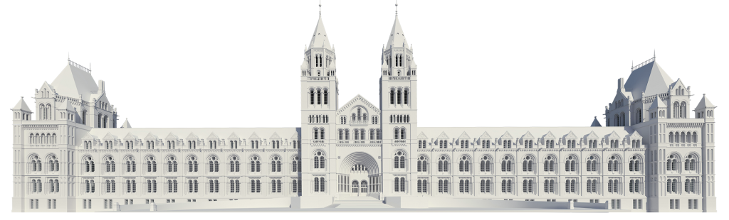
Preserving heritage buildings is both a privilege and a challenge. These architectural treasures offer a glimpse into the past, showcasing craftsmanship and historical significance. However, their preservation requires balancing meticulous care with modern demands. Traditional methods of surveying and documenting these buildings often fall short when it comes to accuracy and non-intrusive techniques.

This is where laser scanning comes into its own, offering an innovative, precise, and non-invasive solution for preserving heritage buildings. At Platinum 3D Consultants, we specialise in using cutting-edge laser scanning and Scan to BIM technology to create accurate digital models of heritage structures. These models serve as invaluable tools for restoration, conservation, and future planning, ensuring these landmarks endure for generations to come.

3D digital models from laser scanning

The Challenges of Preserving Heritage Buildings

Heritage buildings present unique challenges due to their age, complexity, and historical value. Common issues include:

  1. Fragile Structures
    Many heritage buildings are built with materials that have become fragile over time. Traditional surveying methods may risk further damage to the structure.
  2. Complex Architectural Features
    Heritage buildings often include intricate details such as carvings, mouldings, and ornate facades that are difficult to measure and document accurately.
  3. Limited or Outdated Documentation
    Historical records, if they exist, may not reflect the current condition of the building after years of wear, modifications, or environmental impact.
  4. Compliance with Preservation Standards
    Conservation efforts must adhere to strict guidelines, requiring accurate and detailed data to support planning and decision-making.
  5. Balancing Modernisation with Preservation
    Incorporating modern systems, such as HVAC or electrical upgrades, into heritage buildings without disrupting their historical integrity is a delicate process that requires precise planning.

How Laser Scanning Solves These Challenges

Laser scanning of heritage buildings has revolutionised the way we document and preserve heritage buildings. Here’s how it works and why it’s ideal for these delicate projects.

1. Non-Invasive and Accurate Data Collection

Laser scanning captures millions of data points per second, creating a point cloud that represents the building’s geometry with millimetre precision. The process is non-invasive, meaning no physical contact with the structure is required.

  • Platinum 3D’s Expertise:
    Our team uses advanced laser scanners to survey heritage buildings without disturbing their fragile materials or intricate details. This ensures that every element, from grand facades to hidden structural components, is captured accurately.
  • Benefits:
    • Minimises the risk of damage during surveys.
    • Provides a complete and highly detailed record of the building.

2. Detailed Digital Twins for Preservation

The data captured by laser scanning is processed into 3D digital models, also known as digital twins. These models serve as a virtual representation of the building, including all architectural and structural features.

  • Platinum 3D’s Approach:
    Using Scan to BIM technology, we convert point cloud data into BIM-ready Revit models. These models include intricate details, enabling architects and conservationists to visualise the building’s condition and plan restoration efforts with precision.
  • Benefits:
    • Facilitates comprehensive planning for repairs or upgrades.
    • Serves as a long-term digital archive for future reference.

3. Documentation of Intricate Details

Heritage buildings often feature complex architectural details that are challenging to document using traditional methods. Laser scanning captures these features with unparalleled accuracy, preserving their design for future generations.

  • Platinum 3D’s Expertise:
    We ensure that even the most intricate carvings and mouldings are documented in the 3D model, supporting detailed restoration work.
  • Benefits:
    • Allows for accurate replication of features during restoration.
    • Creates a digital record of designs that may otherwise deteriorate over time.

4. Supporting Modernisation Efforts

Laser scanning enables the integration of modern systems, such as electrical, plumbing, or climate control, into heritage buildings without compromising their historical integrity. By identifying potential clashes between new installations and existing structures, laser scanning facilitates seamless upgrades.

  • Platinum 3D’s Services:
    Our geo-referenced models align with real-world coordinates, ensuring that modern interventions fit perfectly within the building’s unique geometry.
  • Benefits:
    • Supports sustainable retrofitting with minimal disruption.
    • Ensures compliance with preservation standards during upgrades.

5. Monitoring Structural Health

Heritage buildings are vulnerable to environmental factors such as weather, pollution, and natural wear. Laser scanning can track changes in the structure over time, helping conservation teams monitor and address issues before they escalate.

  • Platinum 3D’s Approach:
    We provide baseline models that can be compared with future scans to detect shifts, cracks, or deterioration.
  • Benefits:
    • Enables proactive maintenance to extend the building’s lifespan.
    • Provides a reliable tool for assessing structural integrity.
3D building modelling laser scanning

Case Studies: Real-World Applications

Historic Cathedral Restoration

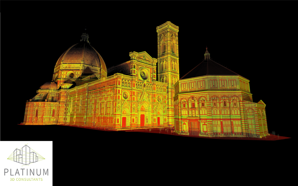
A client needed to document a historic cathedral for restoration planning. Using laser scanning, we captured the cathedral’s intricate stonework, stained glass windows, and vaulted ceilings with millimetre precision. The resulting BIM model allowed the design team to plan repairs while maintaining the building’s historical accuracy.

18th-Century Manor House Conservation

For an 18th-century manor house, we created a detailed 3D model that included structural elements and ornate interiors. This model supported the integration of a modern heating system without altering the building’s historical features.

Unique Benefits of Laser Scanning for Heritage Buildings

  1. Unmatched Accuracy
    Laser scanning captures every detail with precision, ensuring that restoration plans align perfectly with the building’s existing structure.
  2. Time and Cost Efficiency
    By eliminating the need for manual measurements, laser scanning accelerates the survey process and reduces project costs.
  3. Enhanced Collaboration
    Digital models allow architects, engineers, and conservationists to collaborate effectively, working from the same accurate data.
  4. Future-Proofing
    Digital twins provide a long-term record of the building, supporting ongoing maintenance and future renovations.
  5. Sustainability
    By enabling precise planning and efficient resource use, laser scanning contributes to sustainable preservation practices.

Why Choose Platinum 3D Consultants?

At Platinum 3D Consultants, we combine advanced technology with deep expertise to support the preservation of heritage buildings. Our services include:

  • Laser Scanning: Capturing precise data for fragile and complex structures.
  • Scan to BIM: Creating detailed Revit models tailored to restoration and conservation needs.
  • Measured Building Surveys: Providing comprehensive documentation for heritage projects.
  • Geo-Referenced Models: Ensuring spatial accuracy for seamless planning and execution.

With years of experience and a commitment to excellence, we deliver solutions that protect the past while preparing buildings for the future.

Talk To Platinum 3D Consultants

Preserving heritage buildings is a delicate process that demands precision, care, and advanced technology. Laser scanning of buildings and environments offers an unmatched ability to document, analyse, and restore these architectural treasures, ensuring their longevity and historical integrity. At Platinum 3D Consultants, we’re proud to play a role in safeguarding heritage sites, using our expertise to create detailed digital models that support conservation efforts worldwide.

Contact us today to learn how our laser scanning services can help preserve your heritage building. Together, we can protect history for future generations.

How Do 3D Digital Models Improve Facility Management?

3D digital models from laser scanning

Effective facility management is critical for maintaining the functionality, safety, and efficiency of buildings. With the increasing complexity of modern facilities, managing assets, optimising space, and planning maintenance can become overwhelming. This is where 3D digital models, especially those created through Building Information Modelling (BIM), revolutionise facility management.

At Platinum 3D Consultants, we specialise in creating accurate, data-rich 3D models from detailed measured building surveys and laser scanning. These models provide a comprehensive digital twin of your building, enabling better decision-making, streamlined operations, and long-term cost savings.

In this blog, we’ll explore how 3D digital models transform facility management and how Platinum 3D’s services make this transformation seamless.

measured building surveying and laser scanning

The Challenges of Facility Management

Facility managers are responsible for overseeing a wide range of tasks, from day-to-day operations to long-term maintenance planning. Without accurate and up-to-date data, they face several challenges:

  1. Inaccurate or Outdated Building Information
    Buildings often lack comprehensive documentation, particularly if they’ve undergone multiple renovations. Relying on outdated blueprints can lead to errors and inefficiencies.
  2. Complex Building Systems
    Managing HVAC, plumbing, electrical, and structural systems in large facilities can be a daunting task without a clear understanding of their layout and connections.
  3. Space Optimisation
    Efficiently allocating and managing space within a facility is crucial for reducing costs and improving productivity. Without accurate data, this process can be guesswork.
  4. Maintenance Planning
    Scheduling repairs and upgrades without disrupting operations requires detailed knowledge of building systems and their current conditions.

How 3D Digital Models Address These Challenges

A 3D digital model acts as a digital twin of your facility, providing a centralised, data-rich platform for managing every aspect of the building. Here’s how these models improve facility management:

1. Accurate and Centralised Building Data

One of the primary benefits of 3D models is the consolidation of all building information into a single, accessible format. This eliminates the need to rely on scattered documents or outdated plans.

  • What We Do at Platinum 3D:
    Using laser scanning, we capture the existing conditions of your building with millimetre accuracy. This data is converted into a BIM-ready Revit model, which includes all architectural, structural, and mechanical details.
  • Benefits:
    • Instant access to precise data for every part of the building.
    • Streamlined communication across teams using a unified model.

2. Visualisation of Building Systems

Managing a building’s systems—HVAC, plumbing, electrical, and more—becomes significantly easier with a 3D model. These systems can be layered within the model, allowing facility managers to visualise how they connect and interact.

  • What We Do at Platinum 3D:
    Our models incorporate detailed layouts of mechanical and electrical systems, helping facility managers plan maintenance and identify potential issues without needing on-site inspections.
  • Benefits:
    • Quick identification of system locations and connections.
    • Reduced risk of accidental damage during repairs or upgrades.

3. Efficient Space Management

Space optimisation is crucial for reducing operational costs and enhancing productivity. 3D models provide accurate measurements and layouts, enabling facility managers to make informed decisions about how to allocate and use space.

  • What We Do at Platinum 3D:
    Our measured building surveys produce precise floor plans and area referencing, ensuring that every square metre of your building is accounted for.
  • Benefits:
    • Improved space utilisation based on accurate data.
    • Easier planning for expansions or reconfigurations.
laser scanning stadium

4. Proactive Maintenance and Asset Tracking

With a digital twin of your facility, maintenance becomes proactive rather than reactive. Facility managers can track the condition of assets, schedule repairs, and plan upgrades before issues arise.

  • What We Do at Platinum 3D:
    Our 3D models include metadata about building components, such as material specifications, installation dates, and maintenance schedules.
  • Benefits:
    • Reduced downtime through planned maintenance.
    • Longer lifespan for building systems due to timely interventions.

5. Clash Detection and Risk Mitigation

During renovations or upgrades, it’s common for new designs to clash with existing structures or systems. 3D models allow facility managers to identify these conflicts early, avoiding costly on-site adjustments.

  • What We Do at Platinum 3D:
    Our Scan to BIM process includes clash detection capabilities, ensuring that new installations integrate seamlessly with existing systems.
  • Benefits:
    • Fewer project delays and cost overruns.
    • Safer renovations with reduced risk of structural damage.

6. Future-Proofing with Digital Twins

A 3D digital model isn’t just a tool for current operations—it’s an investment in your building’s future. These models serve as a long-term resource, supporting ongoing facility management and future renovations.

  • What We Do at Platinum 3D:
    We create geo-referenced models that align with real-world coordinates, ensuring seamless integration with future technologies and projects.
  • Benefits:
    • Easy integration of renewable energy systems or smart building technologies.
    • Long-term cost savings through informed decision-making.

How Platinum 3D Consultants Support Facility Managers

At Platinum 3D Consultants, we offer a range of services designed to empower facility managers with the tools they need to succeed:

  • Laser Scanning: Capturing millimetre-accurate data for even the most complex facilities.
  • Measured Building Surveys: Providing detailed plans, elevations, and sections to RICS standards.
  • Scan to BIM: Creating BIM-ready Revit models for seamless integration into facility management systems.
  • Geo-Referenced Models: Ensuring spatial accuracy for large or multi-building sites.

By combining these services, we deliver reliable, data-rich models that form the backbone of effective facility management.

Real-World Applications of 3D Digital Models

Case Study: A Commercial Office Complex
One of our clients needed to optimise space usage across a large office building. Using laser scanning and BIM modelling, we provided accurate floor plans and a detailed layout of the building’s HVAC and electrical systems. The client used this data to reconfigure office spaces, reduce energy consumption, and plan future upgrades without disrupting daily operations.

Case Study: A Historic Museum
For a heritage site, we created a 3D model that documented every architectural detail while also integrating modern building systems. Facility managers used the model to plan maintenance, monitor structural integrity, and ensure compliance with preservation regulations.

Talk To Platinum 3D Consultants

3D digital models are transforming the way buildings are managed, offering unparalleled accuracy, efficiency, and long-term value. From streamlining maintenance to optimising space, these models provide facility managers with the insights they need to make informed decisions and achieve operational excellence.

At Platinum 3D Consultants, we specialise in creating accurate, data-rich models tailored to your building’s unique needs. Whether you’re managing a modern office, a historic landmark, or a complex industrial facility, our services ensure that you have the tools to succeed.

Contact us today to learn how our 3D digital modelling services can transform your facility management strategy. Let’s build a smarter, more efficient future for your building.

Why Are Measured Building Surveys Vital for Complex Projects?

measured building surveying

In the ever-evolving world of construction, renovation, and facilities management, accuracy is everything—especially when tackling complex projects. Whether it’s a large commercial development, a historic restoration, or a remote industrial facility, the success of a project depends on precise and comprehensive data about the building. This is where measured building surveys come into play.

At Platinum 3D Consultants, we specialise in delivering highly accurate measured building surveys tailored to meet the unique challenges of complex projects. Using advanced technology such as laser scanning and combining it with years of expertise, we provide detailed documentation that serves as the foundation for efficient planning, design, and execution.

This blog explores why measured building surveys are essential for complex projects and how our services ensure success every step of the way.

Building Measurement 3D Modelling Laser Scanning

What is a Measured Building Survey?

A measured building survey involves capturing precise data about a building’s dimensions, layout, and structural details. This process produces detailed documentation, including floor plans, elevations, sections, and area referencing. For large or complex projects, these surveys are indispensable as they provide an accurate and reliable record of the building’s existing conditions.

At Platinum 3D Consultants, our measured surveys are conducted to the highest professional standards, including RICS and IPMS guidelines. We use advanced laser scanning technology to ensure that every measurement is millimetre-accurate, even in the most intricate or irregular structures.

The Challenges of Complex Projects

Complex projects, by their very nature, come with unique challenges that demand a higher level of accuracy and detail than standard surveys can provide:

1. Large or Irregular Structures

Buildings such as industrial facilities, historic properties, or large commercial spaces often have irregular layouts, varying levels, and unique architectural features. Capturing every detail requires a robust methodology to ensure nothing is missed.

2. Age and Modifications

Older buildings may have undergone multiple renovations or modifications, some of which may not have been properly documented. These hidden changes can pose significant risks during new construction or renovation without accurate data.

3. Multi-Disciplinary Collaboration

Complex projects typically involve input from multiple stakeholders, including architects, engineers, contractors, and project managers. Discrepancies in measurements or data can lead to miscommunication, errors, and delays.

4. Regulatory Compliance

Accurate area referencing is crucial for meeting RICS and IPMS standards, particularly for commercial projects where property valuation, leasing, and transactions are involved.

measured building surveying and laser scanning

How Measured Building Surveys Address These Challenges

1. Comprehensive Documentation

Measured surveys provide a complete and accurate representation of the building’s layout and structure. Our surveys include detailed floor plans, elevations, and sections, ensuring that every aspect of the building is captured. This level of detail supports informed decision-making at every stage of the project.

2. Accurate Area Referencing

Adherence to RICS and IPMS standards ensures that all area calculations are consistent, transparent, and reliable. This is particularly important for commercial and leasing projects, where accurate area measurements can impact valuations, negotiations, and contracts.

3. Enhanced Collaboration

Our measured surveys serve as a single source of truth for all project stakeholders. By providing accurate and consistent data, we help architects, engineers, and contractors work from the same baseline, reducing the risk of miscommunication and errors.

4. Seamless Integration with Modern Technology

At Platinum 3D Consultants, we take measured surveys to the next level by incorporating laser scanning and Scan to BIM. This allows us to convert survey data into BIM-ready Revit models, which can be used for design, clash detection, and facility management.

The Platinum 3D Approach to Measured Building Surveys

At Platinum 3D Consultants, we pride ourselves on delivering accurate, reliable, and efficient measured building surveys tailored to the needs of complex projects. Here’s how we achieve this:

1. Laser Scanning Technology

We use the latest laser scanning equipment to capture dense point cloud data of the building. This ensures that even the most intricate details are recorded with millimetre precision. Laser scanning also allows us to survey hard-to-reach areas safely and efficiently.

2. Customised Survey Deliverables

Every project is unique, and we tailor our survey outputs to meet client needs. Whether you require detailed floor plans, 3D Revit models, or area referencing, we provide the exact level of detail required for your project.

3. Geo-Referenced Data

For larger or multi-building sites, we use geo-referencing to ensure that all data is aligned within a unified coordinate system. This makes it easier to integrate survey data into broader project workflows, especially in multi-disciplinary environments.

4. BIM Integration

Our expertise in Scan to BIM ensures that measured survey data can be seamlessly converted into BIM-ready models. These models are invaluable for planning, design, and ongoing facility management, providing a long-term digital asset for clients.

Unique Benefits of Measured Building Surveys for Complex Projects

1. Precision and Accuracy

Measured surveys eliminate guesswork, providing the precise data needed for informed decision-making. This level of accuracy is critical for avoiding costly mistakes, especially in large or intricate projects.

2. Time and Cost Efficiency

By providing detailed documentation upfront, measured surveys reduce the risk of errors and rework later in the project. This saves time and money while keeping the project on track.

3. Improved Project Coordination

Accurate survey data ensures that all stakeholders, from architects to contractors, are aligned. This fosters better collaboration and minimises the risk of miscommunication or design clashes.

4. Compliance with Standards

For commercial projects, adherence to RICS and IPMS standards ensures that all area measurements are consistent, transparent, and reliable. This is essential for property valuations, leasing, and transactions.

Why Choose Platinum 3D Consultants?

At Platinum 3D Consultants, we bring years of experience and cutting-edge technology to every project we undertake. Our services include:

  • Laser Scanning: Capturing precise, millimetre-accurate data for all types of buildings.
  • Measured Building Surveys: Producing detailed floor plans, elevations, sections, and area referencing to RICS standards.
  • Scan to BIM: Converting survey data into BIM-ready Revit models for collaborative planning and design.
  • Geo-Referenced Data: Ensuring seamless integration of survey data across large or multi-building sites.

Whether you’re managing a heritage restoration, a large commercial project, or a remote industrial site, our measured building surveys provide the accuracy and reliability you need to succeed.

Talk To Platinum 3D Consultants

In complex projects, the importance of accurate building data cannot be overstated. Measured building surveys form the backbone of successful planning, design, and execution, providing the precision and clarity needed to overcome challenges and achieve project goals.

At Platinum 3D Consultants, we are committed to delivering exceptional measured surveys that set the stage for success. By combining advanced technology with unparalleled expertise, we ensure that your project is built on a foundation of accuracy and collaboration.

Get in touch today to learn how our measured building surveys can benefit your project. Let us help you transform complexity into confidence with precision you can trust.

Overcoming the Challenges of Surveying Large, Historic, or Remote Buildings with Modern Technology

measured building surveying and laser scanning

Surveying buildings accurately has always posed challenges, especially when dealing with large, older buildings or those in remote locations. Traditional surveying methods, while valuable, often fall short of capturing the detail and precision required for renovation, restoration, or efficient facility management. However, advances in surveying and modelling technology have transformed how these complex environments are measured and documented.

At Platinum 3D Consultants, we specialise in overcoming these challenges, using a suite of modern services—from laser scanning and measured building surveys to BIM-ready Revit modelling and Scan to BIM technology—to deliver highly accurate, detailed, and actionable digital models for a wide range of projects.

3D digital models from laser scanning

The Unique Challenges of Surveying Large, Older, or Remote Buildings

1. Structural Complexity

Older buildings, particularly historic or listed properties, often include intricate architectural features, non-standard materials, and structural elements that have changed over time. Gothic cathedrals, Victorian museums, and stately homes, for example, might have complex facades, vaulted ceilings, and uneven floors, all of which are difficult to capture accurately with traditional methods.

2. Wear and Alterations Over Time

Buildings that have been used for decades (or even centuries) typically undergo renovations, repairs, and adaptations. These changes, sometimes undocumented, can make it difficult to determine the original structure and layout. Understanding and documenting these modifications is essential for restoration work, modern upgrades, or even risk assessment.

3. Access Limitations

Remote buildings, such as rural estates or offshore facilities, present unique access challenges. Surveyors may face restrictions due to location, weather, or physical constraints, making it difficult to capture the building in its entirety. Safety is also a consideration in precarious or hard-to-reach areas, like roofs or plant rooms in older buildings.

4. Data Volume and Accuracy Requirements

Larger buildings require substantial amounts of data to create a comprehensive and geometrically accurate model. Collecting this data manually is time-consuming and often inconsistent, especially when aiming for millimetre-level accuracy.

How Modern Surveying Technologies Overcome These Challenges

At Platinum 3D Consultants, we use the latest technologies to overcome these challenges, combining laser scanning, BIM-ready Revit modelling, and in-depth measured building surveys to create precise and practical models of any building, regardless of its size, age, or location.

1. Laser Scanning: Capturing Every Detail

Laser scanning, also known as LiDAR (Light Detection and Ranging), is a revolutionary tool in surveying large and intricate buildings. By emitting laser beams and measuring their return time, laser scanners capture point clouds—dense datasets that represent the exact dimensions and geometry of the building. This technology is particularly suited to older buildings where every detail, from decorative cornices to structural beams, needs to be documented.

Our laser scanners can collect up to a million data points per second, which allows us to capture even the most complex spaces in a fraction of the time it would take with traditional methods. The resulting point cloud forms the foundation of a highly accurate, 3D digital representation of the building.

Advantages of Laser Scanning:

  • Precision: Captures every visible element of the building with millimetre accuracy, ensuring no feature is missed.
  • Efficiency: Reduces the need for multiple site visits, capturing comprehensive data in a single pass.
  • Safety: Allows surveyors to capture hard-to-reach or hazardous areas, such as high ceilings or roof spaces, from a safe distance.
laser scanning stadium

2. Measured Building Surveys: Comprehensive Documentation

A measured building survey provides essential details of a building’s layout, structural elements, and overall condition. At Platinum 3D Consultants, we conduct detailed measured surveys to produce floor plans, elevations, sections, and area referencing, adhering to RICS and IPMS standards. This is particularly valuable for large or complex buildings, where multiple stakeholders may need to refer to accurate, standardised measurements.

Measured building surveys complement laser scanning by ensuring that all relevant building elements are documented in an accessible format. These surveys are essential for understanding the building’s structure and layout, which can then be used to guide renovations, facility management, or risk assessments.

Advantages of Measured Building Surveys:

  • Standardisation: All measurements adhere to RICS and IPMS standards, ensuring consistency and accuracy.
  • Usability: Provides clients with clearly documented building information that is easy to reference and integrate into project planning.
  • Versatility: Suitable for both structural assessment and interior planning, offering comprehensive spatial understanding.

3. Scan to BIM: Transforming Data into Actionable Models

Our Scan to BIM service bridges the gap between raw survey data and practical application. After completing a laser scan, we use point cloud data to create BIM-ready Revit models, capturing all relevant details and structural components. BIM (Building Information Modelling) enables us to generate a digital twin of the building, which can be used for design, analysis, or long-term maintenance planning.

Our Revit models can include additional layers of detail, from piping and ductwork to lighting and electrical systems. By incorporating this information, we produce a model that is ready for collaborative design, project management, and even clash detection. This level of detail is invaluable for older buildings, where unanticipated structural complications or utilities can disrupt renovations.

Advantages of Scan to BIM:

  • Accuracy: Transforms point cloud data into geometrically correct Revit models, ensuring consistency across project stages.
  • Collaborative Utility: BIM-ready models allow for collaboration among architects, engineers, and facility managers, all working from the same accurate dataset.
  • Flexibility: Supports future renovations, upgrades, or facility management, making it a versatile tool for ongoing building management.

4. Geo-Referencing: A Unified Coordinate System

For larger buildings, especially those with multiple wings or annexes, geo-referencing all models to a unified coordinate system is essential. At Platinum 3D Consultants, we use geo-referencing to ensure all aspects of the building are aligned within a single spatial framework. This is especially beneficial for large or complex estates, where different parts of the building need to be integrated into a cohesive master model.

Advantages of Geo-Referencing:

  • Alignment: Ensures that each element within the model is positioned accurately, allowing for seamless integration.
  • Efficiency: Supports multi-team collaboration by maintaining spatial consistency across different departments.
  • Enhanced Planning: Enables project teams to work on a single model, reducing discrepancies and streamlining workflows.

The Benefits of Combining These Technologies

By integrating these services—laser scanning, measured building surveys, Scan to BIM, and geo-referencing—Platinum 3D Consultants provide clients with a comprehensive, practical digital model that addresses the unique challenges of large, historic, or remote buildings.

1. Enhanced Accuracy and Detail: With laser scanning and precise measurement techniques, our models capture every nuance of the building’s structure, including fine details and complex architectural features.

2. Improved Collaboration and Communication: BIM-ready models allow project stakeholders, from architects to engineers, to work from the same data-rich model. This unified approach reduces miscommunication, enhances project coordination, and minimises costly errors.

3. Future-Proof Documentation: The BIM-ready Revit models we create are more than just models—they are digital twins, built to support future renovations, restorations, or even facility management, ensuring the building’s longevity.

Bringing Historic and Complex Buildings into the Digital Age

Surveying large, historic, or remote buildings accurately requires a sophisticated approach. At Platinum 3D Consultants, we use the latest technologies to meet the unique challenges these buildings present, ensuring that each model is precise, actionable, and tailored to the client’s needs. By combining laser scanning, measured surveys, and BIM-ready modelling, we provide clients with a robust foundation for their projects, enhancing efficiency, accuracy, and long-term management.

If you have a project involving a large, complex, or remote building, get in touch with Platinum 3D Consultants to learn more about our comprehensive surveying and modelling services. Let us help you bring your building into the digital age, supporting its future with accuracy and innovation.

How BIM and Measured Building Surveys Improve Collaboration in Construction Projects

Scan to BIM

The construction industry is evolving rapidly, driven by technological advancements that make the design, planning, and execution of projects more efficient and accurate. One of the most transformative innovations in recent years is Building Information Modelling (BIM), a digital representation of the physical and functional characteristics of a building. While originally developed for new construction projects, BIM has found significant utility in working with existing structures, particularly when combined with measured building surveys. At Platinum 3D Consultants, we specialise in Scan to BIM, using the latest reality capture technology to create geometrically accurate Revit models from precise survey data. This combination is revolutionising collaboration in construction projects by offering a seamless flow of accurate information across teams.

measured building surveying

The Role of Measured Building Surveys in BIM

Measured building surveys have long been an essential component of renovation, design, and facilities management processes. These surveys provide highly detailed and accurate representations of existing buildings, essential for creating geometrically correct digital models. With the integration of BIM, measured surveys now play a crucial role in documenting and managing the life cycle of a building.

At Platinum 3D Consultants, we use Scan to BIM technology to capture existing conditions through laser scanning. This results in point clouds—dense data sets representing the building in 3D. These point clouds are then used to generate BIM-ready Revit models, which can serve as the foundation for any BIM project involving existing buildings. The accuracy of these models ensures that all stakeholders, from architects to engineers and facility managers, have access to reliable data for planning and execution.

How BIM and Measured Building Surveys Improve Collaboration

One of the most significant advantages of combining BIM with measured building surveys is how it enhances collaboration among the various stakeholders in construction projects. Here are five key ways in which BIM and measured building surveys improve collaboration:

1. Centralised Information Sharing

In traditional construction workflows, information can be fragmented, often leading to communication breakdowns, errors, and delays. BIM changes this by creating a centralised digital model that serves as the single source of truth for all stakeholders. When measured surveys are integrated into the BIM process, this central model becomes a geometrically accurate representation of the existing building.

Having a unified model enables real-time sharing of accurate data between architects, engineers, contractors, and facility managers. With everyone working from the same dataset, there is less room for miscommunication, ensuring that the entire project team is aligned.

2. Improved Accuracy and Reduced Risk

Measured building surveys provide highly accurate data, especially when gathered using laser scanning technologies such as LiDAR. This precision is essential for renovation and refurbishment projects, where understanding the exact dimensions and conditions of the building is critical.

By feeding accurate survey data into a BIM model, the risk of errors is significantly reduced. Teams can rely on this data to plan out renovations, new installations, or structural changes without the guesswork involved in traditional methods. For example, clash detection can be conducted early in the design phase to identify any potential issues between the existing structure and new designs, reducing costly on-site modifications.

measured building surveys

3. Enhanced Design Coordination

When multiple teams are working on a project, coordination is essential to ensure that designs integrate seamlessly. BIM allows for better coordination by providing all project stakeholders with a comprehensive view of the building, including all its mechanical, electrical, and structural systems.

Measured building surveys further enhance this coordination by ensuring that the digital model accurately reflects the current state of the building. Design teams can overlay their plans onto the existing structure with full confidence that measurements and conditions are correct. This ensures that every component of the project fits together perfectly, from new construction to retrofitting or renovations.

4. Streamlined Project Management

BIM and measured building surveys not only improve the accuracy of designs but also enhance project management. By having a precise model of the existing building, project managers can make more informed decisions about scheduling, budgeting, and resource allocation.

Incorporating measured survey data into BIM models also allows for more effective progress monitoring. As the project advances, the digital model can be updated with real-time data, enabling project managers to track progress and ensure that the work is on schedule. This streamlining of project management reduces delays and keeps costs under control.

5. Future-Proofing with Digital Documentation

One of the most significant long-term benefits of using BIM with measured building surveys is the creation of a digital twin of a building. This digital representation becomes an invaluable asset for future projects, renovations, or facility management.

Having a detailed and accurate BIM model of the building ensures that facility managers can easily access data on any part of the structure, from HVAC systems to electrical wiring. This greatly improves the efficiency of maintenance and long-term asset management, reducing operational costs over the building’s lifecycle. Additionally, this digital documentation can be updated and shared easily with new teams in the future, improving collaboration across the building’s life cycle.

The Future of BIM and Measured Building Surveys

As technology continues to evolve, the integration of artificial intelligence (AI) and machine learning into BIM workflows is poised to further revolutionise the industry. AI could automate certain aspects of the modelling process, such as identifying structural elements from point cloud data, making it even easier to create accurate models. Furthermore, AI-powered analytics could help teams predict potential issues and optimise the entire construction process.

At Platinum 3D Consultants, we’re excited to continue pushing the boundaries of what’s possible with Scan to BIM technology. As the industry moves towards more integrated and collaborative approaches to building design, construction, and management, BIM and measured building surveys will continue to play a pivotal role in ensuring project success.

Talk To Platinum 3D

In today’s fast-paced construction industry, collaboration is key. The combination of BIM and measured building surveys offers a powerful toolset that fosters better communication, improves accuracy, and streamlines project management. At Platinum 3D Consultants, our expertise in Scan to BIM allows us to deliver highly detailed and geometrically accurate Revit models from precise survey data, empowering your project team to collaborate effectively from start to finish.

The Evolution of Laser Scanning in Building Surveying: Past, Present, and Future Potential

3D digital models from laser scanning

Laser scanning has revolutionised the way we document, measure, and manage buildings. What once required extensive time on-site, manual measurements, and human calculation is now done with unparalleled precision and speed through the use of laser scanning technology. At Platinum 3D Consultants, we’ve been at the forefront of this transformation, using advanced laser scanning to create geometrically accurate Revit models of existing buildings. This blog will explore the history and evolution of laser scanning, its key benefits, and how emerging technologies such as artificial intelligence (AI) are shaping its future.

The History and Development of Laser Scanning

Laser scanning, also known as LiDAR (Light Detection and Ranging), has its origins in the 1960s when it was first developed for military and aerospace applications. In its early days, laser scanning was used for mapping terrain, creating digital elevation models, and improving accuracy in missile guidance systems. The technology was eventually adapted for civil and commercial use, including the mapping of building interiors and exteriors.

In the 1990s, as computers became more powerful and compact, laser scanning technology started gaining traction in the fields of architecture, engineering, and construction. It provided a fast, efficient, and non-invasive way to capture highly detailed data of physical environments. However, early laser scanners were bulky, expensive, and had limitations in data processing, making them less accessible to mainstream professionals.

By the early 2000s, laser scanning technology became more refined and began to significantly impact the construction and surveying industries. Companies like Platinum 3D Consultants embraced laser scanning to improve the accuracy of building surveys and reduce time spent on-site. Fast forward to today, and laser scanning technology has reached a point where devices can collect up to 1 million data points per second, creating dense point clouds that can be manipulated into 3D models and 2D drawings. These developments have forever changed the way we capture and visualise the built environment.

The Five Key Benefits Laser Scanning Has Brought to the Industry

  1. Unmatched Accuracy and Precision One of the most significant advantages of laser scanning to 3D models of buildings is the precision it offers. Unlike traditional methods of building surveying, which can be prone to human error, laser scanning captures millions of data points with pinpoint accuracy. These data points form a point cloud, which can then be used to create detailed 3D models of the building’s interior and exterior. Architects, engineers, and project managers can trust this data when making decisions, knowing that it accurately reflects the building’s geometry and condition.
  2. Time and Cost Efficiency Laser scanning dramatically reduces the time required on-site for surveys. Where traditional methods may have required multiple visits to collect measurements and verify details, a single laser scanning session can capture all necessary data in a fraction of the time. By minimising time on-site and reducing the need for return visits, laser scanning not only accelerates project timelines but also cuts down on labour costs and potential errors in measurement. Additionally, the dense point cloud allows for revisiting the data virtually, should any additional measurements be required.
  3. Comprehensive Data Capture Unlike traditional surveying methods, which are typically focused on specific elements, laser scanning captures every visible detail in the environment. This comprehensive approach ensures that no features are overlooked. The 3D point cloud generated can be manipulated to zoom in on particular areas of interest or expanded to cover large sections of the building. This wealth of data can be used for everything from building renovations and space planning to historical preservation and facility management.
  4. Clash Detection and Construction Progress Monitoring One of the more advanced applications of laser scanning is its ability to detect clashes between as-built conditions and design models. By comparing the point cloud with virtual 3D models of buildings, construction teams can identify potential issues early in the process, avoiding costly delays and rework. Additionally, laser scanning can be used to monitor the progress of construction by providing accurate records of each phase of the project. This ensures that the work is being carried out according to plan and helps to maintain a high standard of quality throughout the build.
  5. Improved Safety and Accessibility Laser scanning reduces the need for physical access to hard-to-reach or hazardous areas of a building. The non-invasive nature of laser scanning allows surveyors to collect data from a safe distance, which improves site safety and minimises disruption to building operations. For example, in heritage buildings or sites undergoing renovation, laser scanning can document structural conditions without compromising the integrity of the space or putting workers at risk.
3D digital models from laser scanning

The Future of Laser Scanning: AI and Beyond

As we look to the future, the integration of artificial intelligence (AI) with laser scanning technology is poised to take this method of building surveying to the next level. AI has the potential to automate aspects of the data analysis process, making it easier and faster to turn raw point cloud data into actionable insights.

For example, AI could be used to automatically identify structural elements such as walls, beams, and columns from the point cloud data, saving significant time and labour in post-processing. AI-driven algorithms may also enhance clash detection by learning to recognise common issues or predict potential conflicts based on historical data. This would enable project teams to proactively resolve issues before they become problems on-site.

Additionally, as AI continues to improve, we see laser scanning technology become even more accessible to smaller firms and projects. Automated drones equipped with AI-powered laser scanners are the next way to capture entire buildings with minimal human oversight, further reducing time and costs.

At Platinum 3D Consultants, we remain committed to staying ahead of technological developments in the field of laser scanning. By continuing to invest in the most up-to-date scanning equipment and exploring the possibilities that AI brings, we aim to offer our clients the most accurate and efficient surveying services available.

Talk To Platinum 3D Consultants

The history and evolution of laser scanning have transformed how we measure and model buildings, bringing unparalleled accuracy, efficiency, and safety to the process. With the ability to capture vast amounts of data in a short amount of time, laser scanning has become an essential tool for architects, engineers, and construction professionals. Looking ahead, the integration of AI promises to push the boundaries of what’s possible, making laser scanning even more powerful and accessible. At Platinum 3D Consultants, we are excited to be part of this journey, helping our clients take full advantage of these advancements in building surveying technology.