Step-by-Step: How Laser Scanning Works and Why It’s Superior to Traditional Building Survey Methods

3D Model of Building from Laser Scanning

In the modern world of construction, architecture, and facility management, capturing accurate measurements of existing buildings is essential for everything from renovation projects to maintenance and asset management. Traditional methods of measuring buildings, while reliable, are being rapidly overtaken by the more advanced and efficient technique of laser scanning. At Platinum 3D Consultants, we specialise in using the latest laser scanning technology to create geometrically accurate 3D models of buildings and environments from detailed survey data.

This blog will take you through a step-by-step guide on how laser scanning of a building works, how it’s transformed into a 3D model, and why it surpasses traditional surveying methods.

laser scanning stadium

Step 1: Site Preparation and Planning

Before the laser scanning process begins, the site is assessed and strategically planned to ensure comprehensive coverage of the building. Areas of interest, such as structural features, mechanical systems, or specific spaces, are identified. While laser scanning can capture millions of data points per second, having a clear plan ensures efficiency and accuracy.

At this stage, control points may be established throughout the building. These control points act as reference markers, ensuring that all the laser scans are aligned correctly and that the data can be geo-referenced later for accurate integration into broader project workflows.

Step 2: Laser Scanning Data Collection

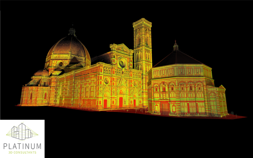
The laser scanning process involves using a 3D scanner, typically mounted on a tripod, which emits millions of laser beams at the surface of the building. The scanner captures these beams as they bounce back, measuring the exact time it takes for the light to return to the device. By repeating this process across every angle of the building, the scanner creates a dense point cloud of data.

The density of the point cloud ensures that no part of the building is missed, with up to 1 million data points collected every second. This results in an incredibly detailed and accurate digital representation of the building’s geometry, down to the smallest features like fixtures, fittings, and structural elements.

Benefits of Laser Scanning:

  • Speed: Laser scanning captures millions of data points in a fraction of the time required by traditional surveying methods.
  • Accuracy: The level of precision in a laser scan is unmatched, ensuring even the most complex spaces are captured in detail.
  • Minimal Disruption: The non-intrusive nature of laser scanning allows surveyors to work without significant disruption to the building’s normal operations.

Step 3: Processing the Point Cloud Data

Once the data is collected, it is processed to create a detailed point cloud of the building. The point cloud is a 3D representation of the building, where each point represents a specific location on the surface. It is an incredibly accurate snapshot of the building, including every visible element.

This data is then processed using advanced software to filter out noise, refine accuracy, and stitch together multiple scans into a single, unified 3D model. At this stage, the point cloud can be manipulated and analysed to extract the necessary information, such as floor plans, elevations, and structural details.

Step 4: Creating a 3D BIM Model

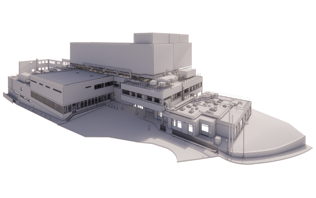
The next step involves converting the point cloud data into a BIM-ready model, usually in Revit. At Platinum 3D Consultants, we take the processed point cloud data and generate accurate 3D models of the building, including all relevant architectural, mechanical, and structural elements. Depending on the project requirements, the models can include varying levels of detail (LOD) for different building features, such as piping, ducting, or electrical systems.

The resulting model is highly precise and geometrically correct, making it suitable for use in any project phase, whether it’s renovation, facilities management, or ongoing maintenance.

3D digital models from laser scanning

Why Laser Scanning is Better than Traditional Survey Methods

While traditional building surveys typically rely on manual measurement tools, such as tape measures, total stations, or theodolites, laser scanning offers several distinct advantages over these methods.

1. Unparalleled Speed and Efficiency

Traditional methods are time-consuming and require multiple visits to gather accurate measurements, especially for large or complex buildings. Laser scanning, on the other hand, captures millions of data points in just seconds, covering every nook and cranny of a structure in a single visit. This not only speeds up the surveying process but also reduces the need for return trips, cutting down overall project timelines and costs.

2. Higher Accuracy

Manual measurements are prone to human error, and even the most skilled surveyor may miss subtle details. Laser scanning captures data at millimetre-level accuracy, ensuring that every aspect of the building, from walls to decorative elements, is captured in its true dimensions. The precision of the point cloud data ensures that when converted into a 3D model, the information is reliable and accurate.

3. Comprehensive Data Capture

Traditional methods usually require selective measuring, meaning only key points or sections of the building are surveyed. Laser scanning captures everything—every visible surface, angle, and detail—ensuring a complete and comprehensive dataset. This is especially important for renovation projects, where understanding the exact conditions of the building is critical.

4. Cost-Effective in the Long Run

While laser scanning technology may have higher initial costs, the efficiency and accuracy it brings to a project means fewer errors, less rework, and more informed decision-making. This translates to significant savings over the life of a project, especially for large or complex buildings.

5. Digital Integration

Laser scanning data is easily integrated into BIM software, providing project teams with a digital twin of a building. Traditional surveying methods often require manual transcription of data into digital formats, which introduces the risk of further errors. With laser scanning, the data is already in a digital format, ready for immediate use in CAD or BIM environments.

Alternatives to Laser Scanning

Before the widespread adoption of laser scanning, total stations, GPS surveying, and photogrammetry were common alternatives. While these methods are still in use today, they have limitations in terms of speed, accuracy, and flexibility compared to laser scanning.

  • Total Stations: Total stations are accurate for individual points but require manual operation for each measurement, which can be time-consuming and labour-intensive.
  • Photogrammetry: While useful for large-scale landscape surveys, photogrammetry lacks the millimetre precision of laser scanning and is less effective for complex interior spaces.

Talk To Platinum 3D Consultants

Laser scanning has transformed the field of building measurement and modelling, offering speed, accuracy, and cost savings that far surpass traditional methods. At Platinum 3D Consultants, we are experts in capturing and converting this data into BIM-ready Revit models, helping our clients streamline their construction, renovation, and facility management projects. If you’re looking for precise, efficient, and future-proof survey solutions, laser scanning is the answer. Get in touch with us today to learn more about how we can assist with your project.

The Evolution of Laser Scanning in Building Surveying: Past, Present, and Future Potential

3D digital models from laser scanning

Laser scanning has revolutionised the way we document, measure, and manage buildings. What once required extensive time on-site, manual measurements, and human calculation is now done with unparalleled precision and speed through the use of laser scanning technology. At Platinum 3D Consultants, we’ve been at the forefront of this transformation, using advanced laser scanning to create geometrically accurate Revit models of existing buildings. This blog will explore the history and evolution of laser scanning, its key benefits, and how emerging technologies such as artificial intelligence (AI) are shaping its future.

The History and Development of Laser Scanning

Laser scanning, also known as LiDAR (Light Detection and Ranging), has its origins in the 1960s when it was first developed for military and aerospace applications. In its early days, laser scanning was used for mapping terrain, creating digital elevation models, and improving accuracy in missile guidance systems. The technology was eventually adapted for civil and commercial use, including the mapping of building interiors and exteriors.

In the 1990s, as computers became more powerful and compact, laser scanning technology started gaining traction in the fields of architecture, engineering, and construction. It provided a fast, efficient, and non-invasive way to capture highly detailed data of physical environments. However, early laser scanners were bulky, expensive, and had limitations in data processing, making them less accessible to mainstream professionals.

By the early 2000s, laser scanning technology became more refined and began to significantly impact the construction and surveying industries. Companies like Platinum 3D Consultants embraced laser scanning to improve the accuracy of building surveys and reduce time spent on-site. Fast forward to today, and laser scanning technology has reached a point where devices can collect up to 1 million data points per second, creating dense point clouds that can be manipulated into 3D models and 2D drawings. These developments have forever changed the way we capture and visualise the built environment.

The Five Key Benefits Laser Scanning Has Brought to the Industry

  1. Unmatched Accuracy and Precision One of the most significant advantages of laser scanning to 3D models of buildings is the precision it offers. Unlike traditional methods of building surveying, which can be prone to human error, laser scanning captures millions of data points with pinpoint accuracy. These data points form a point cloud, which can then be used to create detailed 3D models of the building’s interior and exterior. Architects, engineers, and project managers can trust this data when making decisions, knowing that it accurately reflects the building’s geometry and condition.
  2. Time and Cost Efficiency Laser scanning dramatically reduces the time required on-site for surveys. Where traditional methods may have required multiple visits to collect measurements and verify details, a single laser scanning session can capture all necessary data in a fraction of the time. By minimising time on-site and reducing the need for return visits, laser scanning not only accelerates project timelines but also cuts down on labour costs and potential errors in measurement. Additionally, the dense point cloud allows for revisiting the data virtually, should any additional measurements be required.
  3. Comprehensive Data Capture Unlike traditional surveying methods, which are typically focused on specific elements, laser scanning captures every visible detail in the environment. This comprehensive approach ensures that no features are overlooked. The 3D point cloud generated can be manipulated to zoom in on particular areas of interest or expanded to cover large sections of the building. This wealth of data can be used for everything from building renovations and space planning to historical preservation and facility management.
  4. Clash Detection and Construction Progress Monitoring One of the more advanced applications of laser scanning is its ability to detect clashes between as-built conditions and design models. By comparing the point cloud with virtual 3D models of buildings, construction teams can identify potential issues early in the process, avoiding costly delays and rework. Additionally, laser scanning can be used to monitor the progress of construction by providing accurate records of each phase of the project. This ensures that the work is being carried out according to plan and helps to maintain a high standard of quality throughout the build.
  5. Improved Safety and Accessibility Laser scanning reduces the need for physical access to hard-to-reach or hazardous areas of a building. The non-invasive nature of laser scanning allows surveyors to collect data from a safe distance, which improves site safety and minimises disruption to building operations. For example, in heritage buildings or sites undergoing renovation, laser scanning can document structural conditions without compromising the integrity of the space or putting workers at risk.
3D digital models from laser scanning

The Future of Laser Scanning: AI and Beyond

As we look to the future, the integration of artificial intelligence (AI) with laser scanning technology is poised to take this method of building surveying to the next level. AI has the potential to automate aspects of the data analysis process, making it easier and faster to turn raw point cloud data into actionable insights.

For example, AI could be used to automatically identify structural elements such as walls, beams, and columns from the point cloud data, saving significant time and labour in post-processing. AI-driven algorithms may also enhance clash detection by learning to recognise common issues or predict potential conflicts based on historical data. This would enable project teams to proactively resolve issues before they become problems on-site.

Additionally, as AI continues to improve, we see laser scanning technology become even more accessible to smaller firms and projects. Automated drones equipped with AI-powered laser scanners are the next way to capture entire buildings with minimal human oversight, further reducing time and costs.

At Platinum 3D Consultants, we remain committed to staying ahead of technological developments in the field of laser scanning. By continuing to invest in the most up-to-date scanning equipment and exploring the possibilities that AI brings, we aim to offer our clients the most accurate and efficient surveying services available.

Talk To Platinum 3D Consultants

The history and evolution of laser scanning have transformed how we measure and model buildings, bringing unparalleled accuracy, efficiency, and safety to the process. With the ability to capture vast amounts of data in a short amount of time, laser scanning has become an essential tool for architects, engineers, and construction professionals. Looking ahead, the integration of AI promises to push the boundaries of what’s possible, making laser scanning even more powerful and accessible. At Platinum 3D Consultants, we are excited to be part of this journey, helping our clients take full advantage of these advancements in building surveying technology.

The Rise of Matterport Virtual Tours: Revolutionising Remote Site Visits

matterport

Measured building surveying has long been a cornerstone of architectural, construction, and property management projects, providing essential data for accurately assessing and documenting building structures. Over the years, advancements in technology have transformed the way measured building surveys are conducted, offering unprecedented accuracy and detail through tools such as laser scanning. One of the most exciting developments in recent years is the integration of Matterport virtual tours, which enable stakeholders to remotely explore sites with ease.

At Platinum 3D Consultants, we combine our expertise in measured building surveying and 3D modelling with Matterport technology to provide comprehensive virtual site tours, giving clients and project teams a powerful tool to navigate and visualise properties without being physically present.

measured building surveying

The Origins of Measured Building Surveying

Measured building surveying has its roots in traditional surveying methods, where surveyors would use manual tools such as tape measures, theodolites, and compasses to record the dimensions and conditions of buildings. These early techniques were time-consuming and susceptible to human error, often leading to inaccuracies in the data collected.

The need for more precise and efficient methods of documenting building dimensions led to the development of laser scanning technology. Laser scanning, which uses laser beams to capture millions of data points from a building’s surface, revolutionised measured surveying. The result is a highly accurate and detailed point cloud that can be used to create 3D models or detailed floor plans, providing architects, engineers, and project managers with reliable data for their projects.

As experts in this field, Platinum 3D Consultants have continually invested in the latest laser scanning technology, ensuring that our surveys provide geometrically accurate data that can be used to create detailed Revit models of existing structures.

Enter Matterport: The Future of Remote Site Visits

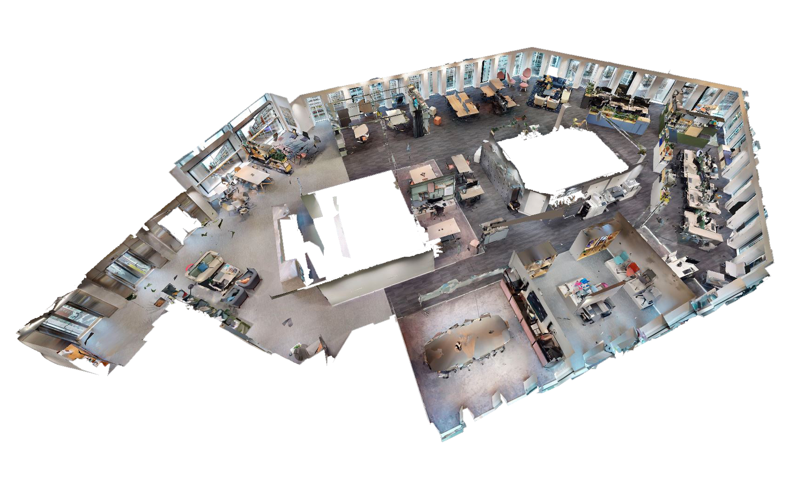
While laser scanning has revolutionised the precision of building surveys, Matterport virtual tours have introduced a whole new level of accessibility and convenience. Matterport is a cutting-edge platform that uses 3D cameras to capture immersive virtual walkthroughs of buildings, enabling stakeholders to explore spaces remotely from anywhere in the world.

At Platinum 3D Consultants, we utilise Matterport’s technology alongside our measured building surveys to give clients the ability to virtually visit their properties without needing to be on-site. This advancement is particularly valuable in an era where remote work and digital collaboration have become more prevalent.

The Many Benefits of Matterport Virtual Tours for Stakeholders

The introduction of Matterport virtual tours to the measured building surveying process offers a wide range of benefits for various stakeholders, including architects, engineers, project managers, facility managers, and property developers. Here’s how this technology is making a difference:

1. Remote Access to Sites

One of the most obvious advantages of Matterport virtual tours is the ability to visit and explore sites remotely. Whether stakeholders are located in different regions or countries, they can access a full 3D walkthrough of the building at any time. This eliminates the need for costly and time-consuming travel, making it easier for global teams to collaborate and make informed decisions quickly.

For example, architects can remotely view the exact conditions of a building’s interior and exterior, engineers can assess structural elements, and project managers can monitor progress without physically being on-site. This is especially beneficial in situations where travel restrictions or safety concerns make in-person visits difficult.

2. Improved Collaboration and Communication

Matterport virtual tours facilitate better communication among project stakeholders. Instead of relying solely on photos or blueprints, teams can walk through a digital twin of the building and interact with the space in real-time. This leads to more effective discussions about design, construction, and renovation projects.

Additionally, virtual tours help ensure that everyone involved in the project is working from the same accurate visual data, reducing the risk of misunderstandings or misinterpretations. Engineers, architects, contractors, and facility managers can collaborate more seamlessly, making adjustments or revisions based on a shared understanding of the current state of the building.

3. Enhanced Visualisation for Clients and Investors

For clients, property developers, and investors, Matterport virtual tours provide a detailed, interactive view of a building or site that is far superior to static images or traditional 2D floor plans. Being able to “walk through” a property remotely allows potential buyers, tenants, or investors to experience the space firsthand, helping them make more confident decisions.

Whether showcasing a completed development to potential buyers or presenting progress to stakeholders, Matterport tours offer a highly engaging and immersive way to visualise the property. This can be particularly advantageous when marketing high-end commercial or residential developments, as it allows investors to feel more connected to the project from a distance.

4. Efficient Facility Management and Maintenance

Facility managers can also benefit greatly from Matterport virtual tours. By having a detailed, up-to-date 3D model of a building, managers can monitor and plan maintenance tasks more effectively. Rather than conducting repeated on-site inspections, managers can remotely assess the condition of various building systems, identify areas in need of maintenance, and even use the virtual model to share visual information with contractors or technicians.

For larger properties with complex layouts, having access to a Matterport virtual tour can save considerable time and effort in managing ongoing operations. It also reduces downtime by enabling quick and informed decision-making regarding repairs, upgrades, or space utilisation.

5. Comprehensive Documentation for Future Use

Matterport virtual tours serve as a permanent digital record of a building’s condition at the time of capture. This can be invaluable for future renovations, repairs, or historical preservation efforts. With the ability to reference a detailed 3D model, architects and engineers can plan new projects with confidence, knowing that they are working with an accurate representation of the building as it exists.

Additionally, having this documentation on hand can help ensure compliance with regulatory requirements or support insurance claims in the event of damage or unforeseen issues.

virtual tours

Combining Precision and Virtual Accessibility

At Platinum 3D Consultants, we believe in combining the best of both worlds: the precision of laser scanning for measured building surveys and the immersive accessibility of Matterport virtual tours. Together, these technologies empower stakeholders across industries to make faster, more informed decisions, enhance collaboration, and ultimately save time and resources on their projects.

Whether you’re an architect looking to refine your design, a project manager monitoring construction progress, or a facility manager seeking a more efficient way to oversee building operations, our expert team is here to provide you with the most advanced solutions available. By integrating measured surveys with Matterport technology, we offer a comprehensive and seamless approach to managing buildings and properties—remotely and with precision.

The Evolution of Measured Building Surveying: Transforming the Industry for Architects, Engineers, and More

3D building modelling laser scanning

Measured building surveying has revolutionised the way professionals approach design, construction, and maintenance across a wide range of industries. From architects to facility managers, this precise and detailed method of capturing a building’s dimensions and conditions has brought significant improvements to efficiency, accuracy, and project management. As experts in the field, Platinum 3D Consultants have witnessed the tremendous impact of this technology and continue to lead the industry by providing geometrically accurate 3D models and Revit models using the latest surveying tools and techniques.

laser scanning stadium

The Origins of Measured Building Surveying

Measured building surveying traces its origins to traditional land surveying, where the primary focus was on capturing the geographical and dimensional features of land and structures. Early methods relied on manual tools like tape measures, compasses, and theodolites, which, while effective for their time, were labour-intensive and prone to human error.

With the advent of modern technology, particularly the integration of digital laser scanning and other advanced measurement techniques, measured building surveying evolved into a highly accurate and efficient process. Today, surveying involves using laser scanners, drones, and computer software to capture and analyse vast amounts of data, transforming the way we document, design, and manage buildings.

How Measured Building Surveying Has Changed the Game

Measured building surveying has fundamentally shifted the way that key professionals—including architects, engineers, project managers, consultants, and facility managers—approach their work. Here’s how it has reshaped the landscape for these roles:

1. Architects: Improving Design Accuracy and Creativity

For architects, measured building surveys provide an essential foundation upon which to design new buildings or refurbishments. Traditional methods of measuring buildings often lacked the precision required to accurately capture every dimension and detail. In contrast, modern surveying tools such as laser scanners generate highly accurate point clouds, which are then converted into 3D models or Revit files.

With access to these detailed and geometrically precise models, architects can confidently design within the existing parameters, ensuring that new elements will integrate seamlessly with the existing structure. This eliminates guesswork, reduces the risk of costly errors, and allows for greater creativity as architects can work from a reliable digital representation of the building. As experts in creating Revit models, Platinum 3D Consultants ensure that architects receive the most accurate data possible to support their design vision.

2. Engineers: Supporting Structural Integrity and Efficiency

Engineers rely on accurate data to ensure the structural integrity of buildings. Measured building surveying provides a precise representation of the building’s geometry, allowing engineers to assess load-bearing elements, identify structural weaknesses, and plan renovations or expansions with confidence. Laser scanning can detect even minute deviations from design specifications, helping engineers make informed decisions about structural safety.

By capturing precise measurements of critical features such as beams, columns, and foundations, measured surveys streamline the engineering process. This precision not only ensures compliance with safety standards but also enables engineers to explore more innovative and efficient solutions, resulting in better-engineered buildings.

3D digital models from laser scanning

3. Project Managers: Enhancing Coordination and Minimising Risk

Project managers often juggle multiple aspects of construction or renovation projects, from timelines to budgets. Measured building surveys provide them with a single source of truth—a detailed and accurate representation of the building. With this data, project managers can coordinate more effectively with architects, engineers, and contractors, ensuring that all parties are working from the same information.

This high level of accuracy helps reduce misunderstandings and errors that can lead to costly project delays. Additionally, measured building surveys enable project managers to anticipate potential challenges, such as spatial constraints or structural complications, before they become critical issues, mitigating risks and improving overall project efficiency.

4. Consultants: Informing Strategic Decision-Making

Consultants play a key role in advising clients on everything from building condition assessments to long-term sustainability strategies. Measured building surveys provide consultants with a comprehensive view of the building’s physical attributes, allowing them to make data-driven recommendations. Whether it’s advising on energy efficiency upgrades or guiding a renovation project, consultants rely on accurate data to deliver value to their clients.

At Platinum 3D Consultants, our detailed surveys equip consultants with the information needed to deliver insights that optimise building performance, sustainability, and functionality.

5. Facility Managers: Streamlining Maintenance and Asset Management

For facility managers, having access to accurate, up-to-date data on a building’s layout and features is invaluable. Measured building surveys provide a detailed digital record of the building, which can be used to manage space planning, maintenance schedules, and asset management. For example, the 3D digital models created from laser scanning data allow facility managers to visualise building systems, such as HVAC and electrical, and plan maintenance without needing to conduct extensive site visits.

By using precise models, facility managers can reduce downtime, plan for future upgrades, and ensure that maintenance is carried out efficiently. This leads to cost savings over the long term and improves the operational efficiency of the building.

The Unique Benefits of Measured Building Surveying

Measured building surveying offers a range of unique benefits that make it a valuable tool for professionals across various industries:

  • Accuracy and Detail: Modern surveying techniques, especially laser scanning, capture every detail of a building’s structure, from large-scale features to intricate architectural details. This data ensures that all professionals working on the project have access to the same high-quality information.
  • Cost and Time Efficiency: Measured building surveys significantly reduce the need for multiple site visits, saving time and minimising costs associated with delays and errors.
  • Flexibility: The data captured during a measured survey can be used for a variety of purposes, including creating 2D drawings, 3D models, and conducting clash detection, making it a highly versatile tool for different stages of a project.

Embracing the Future with Measured Building Surveys

The evolution of measured building surveying has changed the way architects, engineers, project managers, consultants, and facility managers approach their work. By offering unparalleled accuracy, efficiency, and flexibility, these surveys provide a strong foundation for better decision-making, smoother project management, and innovative design. At Platinum 3D Consultants, we pride ourselves on delivering precise and detailed surveys that empower our clients to achieve their goals with confidence.

How The Power of Laser Scanning Is Revolutionising 3D Building Modelling for the Modern Era

laser scanning stadium architectural drawings

In the rapidly evolving world of architecture, construction, and heritage conservation, the demand for precise, detailed, and efficient 3D modelling of buildings has never been higher. Laser scanning technology has emerged as a groundbreaking solution, transforming how professionals capture and visualise existing building structures. Platinum 3D Consultants, with over two decades of expertise, leverage cutting-edge laser scanning technology to create highly accurate Revit models, setting new standards in the industry. But just how does laser scanning work, and why is it so effective? Let’s explore the process, the benefits it brings, and who stands to gain the most from these advanced 3D models.

How Laser Scanning Works: Speed and Precision

Laser scanning, also known as LiDAR (Light Detection and Ranging), is a technique that uses laser beams to capture the exact shape of objects, buildings, and landscapes. By emitting laser pulses and measuring the time it takes for them to bounce back, these scanners can generate up to 1 million data points per second. This process results in a dense ‘point cloud,’ which is a highly detailed, three-dimensional representation of the scanned environment.

At Platinum 3D Consultants, our state-of-the-art 3D scanners can swiftly and accurately map the existing context or environment, capturing every detail with precision. This rapid data collection minimises time on site and reduces the need for multiple visits, making it a highly cost-effective solution. Once the point cloud data is collected, our in-house experts manipulate and enhance it to produce precise 3D models or 2D drawings. This data can also be utilised for clash detection, comparing the as-built object with the virtual model to identify discrepancies and track construction progress.

laser scanning for 3D models of buildings

Why Laser Scanning is So Effective for 3D Modelling

  1. Accuracy and Detail: Laser scanning provides a level of accuracy and detail that is unmatched by traditional measurement methods. The ability to capture millions of data points means that every aspect of the building’s structure is recorded, from large structural elements to minute details. This results in geometrically accurate 3D models of buildings that are essential for precise planning and decision-making.
  2. Efficiency and Speed: Traditional surveying methods can be time-consuming and labour-intensive, often requiring multiple site visits. In contrast, laser scanning significantly reduces time spent on-site, capturing data swiftly and thoroughly. This efficiency not only speeds up the modelling process but also lowers costs, making high-quality 3D models more accessible.
  3. Versatility: Laser scanning is suitable for a wide range of applications, from mapping complex building interiors to capturing expansive landscapes. This versatility allows it to be used in various industries, including architecture, construction, engineering, and heritage conservation.
  4. Enhanced Safety: The ability to scan buildings and structures remotely reduces the need for physical access, especially in hazardous or hard-to-reach areas. This enhances safety for surveyors and minimises the risk of accidents on-site.
3D building modelling laser scanning

The Many Benefits of 3D Laser Scanning Models

The use of 3D laser scanning models brings a multitude of benefits, providing value to a diverse range of stakeholders:

  • Architects and Designers: Accurate 3D models allow architects and designers to visualise and plan projects with greater precision. The detailed point cloud data supports the creation of accurate Revit models, ensuring that designs are based on the exact dimensions and features of the existing structure. This accuracy is crucial for designing modifications or extensions that integrate seamlessly with the current building.
  • Construction Professionals: For builders and contractors, 3D models provide a clear and detailed representation of the project, reducing the likelihood of errors and rework. The ability to conduct clash detection ensures that potential issues are identified early, avoiding costly delays during construction.
  • Facility Managers: Managing and maintaining buildings becomes more efficient with access to precise 3D models. Facility managers can use these models for space planning, asset management, and maintenance scheduling, ensuring that building operations run smoothly and efficiently.
  • Heritage Conservationists: Preserving historic buildings requires detailed documentation of existing conditions. Laser scanning provides an invaluable tool for conservationists, capturing every detail of heritage sites without causing damage. The resulting 3D models serve as digital archives, aiding in the restoration and preservation of cultural landmarks.

The Future of Building Modelling

As technology continues to advance, the role of laser scanning in building modelling is set to expand even further. At Platinum 3D Consultants, we remain at the forefront of this evolution, continually investing in the latest laser scanning technology and software. Our commitment to excellence ensures that our clients receive the most accurate, efficient, and reliable 3D models available.

Laser scanning has revolutionised the way we capture and model the built environment. Its accuracy, efficiency, and versatility make it an indispensable tool for architects, builders, facility managers, and conservationists alike. By embracing this technology, we can build a future where design and construction are more precise, efficient, and sustainable than ever before. 

Contact Platinum 3D Consultants

Ready to experience the precision and efficiency of laser scanning for your next project? Contact Platinum 3D Consultants today to discuss how our expert team can help you create geometrically accurate 3D models and Revit models of your existing buildings. Whether you’re an architect, builder, facility manager, or conservationist, we have the solutions to meet your needs. Get in touch now to discover the benefits of advanced laser scanning technology.

Smithfield Market

measured building surveying

Smithfield Market

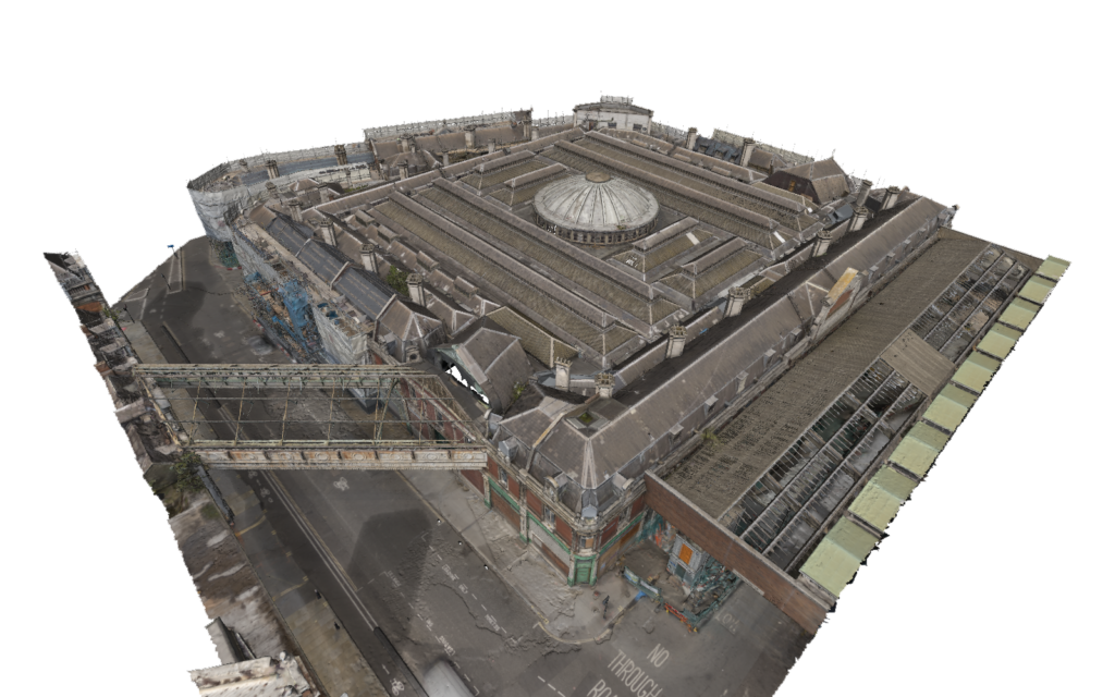
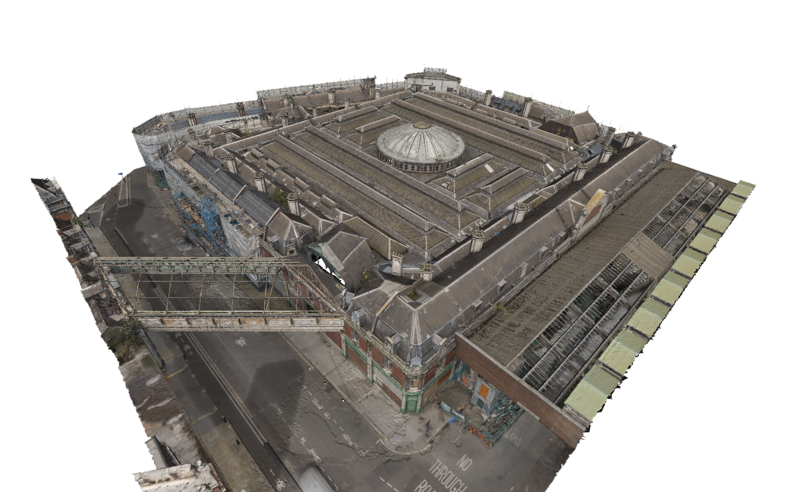
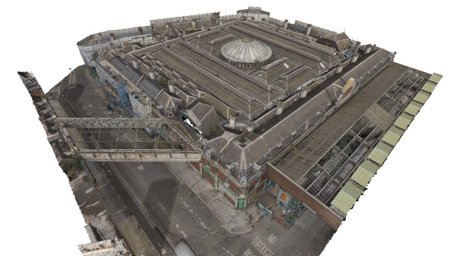
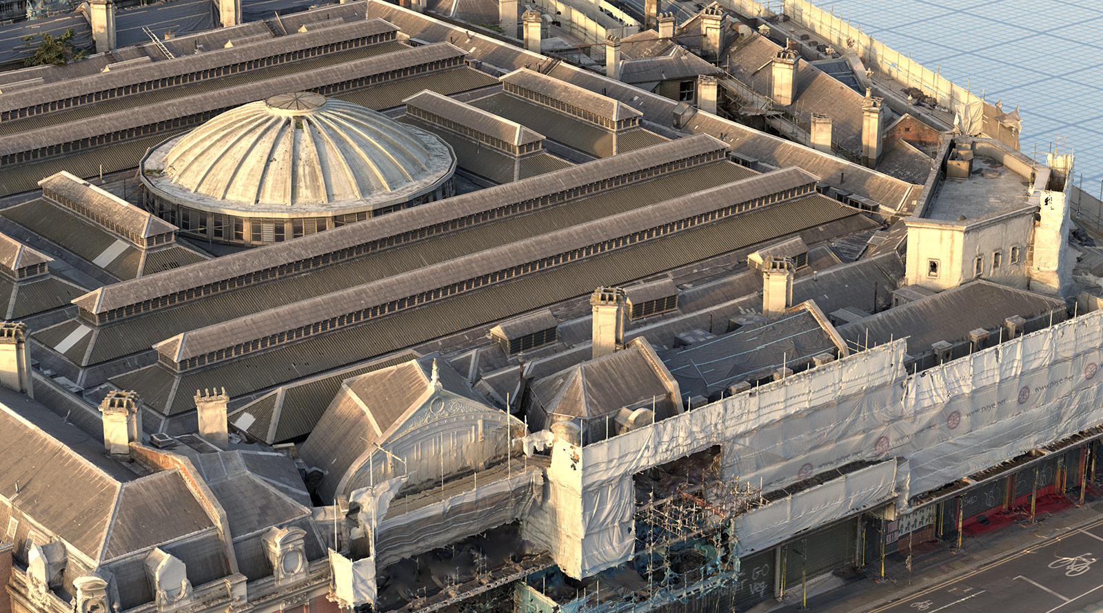
The General Market building in West Smithfield is being repurposed as the new home of the Museum of London. Renovation works are underway and partial demolition of the building’s interior has exposed previously hidden structural components. Platinum 3D Consultants were requested to provide a comprehensive laser scan survey of the ground floor’s newly exposed structure and the complex roof structure to both meet the project’s BIM level 2 obligations and as an important tool to inform the conservation and renovation process.

The derelict building is in a poor state of repair with parts of the roof suffering severe degradation due to water ingress, so access is limited. The best approach was to combine both terrestrial laser scanning and aerial photogrammetry to ensure even limited access areas could be recorded in detail. In partnership with Visualskies, experts in aerial data capture, we recorded this complex, historic building.

A high-definition coloured point cloud with limited occlusions was delivered to the client. The data has been used successfully by the stone conservation contractors to manage their work and aid the installation of structural steel and reconditioned windows.