
Virtual tours are far more than a “nice to have” marketing tool. In the hands of experienced professionals like Platinum 3D Consultants, they become a fundamental reference layer across disciplines. From clients and planners to contractors and facility managers, a properly built virtual tour of a building or environment, anchored to accurate survey data helps every stakeholder see, comment, and decide with confidence.
What Is a Virtual Tour and Why Does It Matter?
Virtual tours (often using platforms like Matterport) allow users to explore a building in 3D from their screens. They capture 360° images and depth information to provide immersive walkthroughs. Compared to static photos or 2D floor plans, these tours give spatial context, show hidden corners, and help users “feel” the real space. Because they can be shared remotely, they reduce the need for multiple site visits, cut permit overheads, and streamline communication in projects where access or safety is a concern.
For instance, in high‑risk areas or constrained industrial zones, virtual tours let teams conduct pre‑planning walkthroughs, identify hazards, and orient themselves before stepping foot on site. This reduces downtime and improves Health & Safety preparedness.
How Virtual Tours Integrate with Laser Scanning and BIM
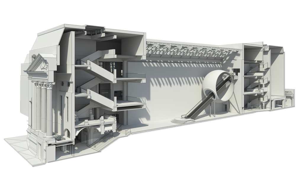
A virtual tour alone offers great visual insight, but combining it with a survey‑grade laser scan and BIM model supercharges its value. At Platinum 3D, we generate virtual tours from the same data capture session that creates point clouds, Revit models and geo‑referenced datasets. This means the walkthrough reflects the exact geometry and conditions of the building.
Architects can cross-reference what they see in the tour with the precise model. Contractors can check visual configurations before installing systems. Facility managers gain a visual asset tied to build data. Because the data is anchored in real-world coordinates, everything aligns: the tour, the model, and real site conditions.
Everyone Gains from Visual Clarity
Clients and investors can explore proposed spaces, understand constraints, and assess aesthetics without needing constant site visits. Planning authorities and heritage bodies can visualise how interventions affect existing fabric. Contractors and trade partners can pre‑review installation approaches, detect clashes, or coordinate sequencing. Facilities and operations teams can visualise plant rooms, access routes or maintenance areas before works begin.
By giving everyone access to the same “visual reference”, virtual tours reduce misunderstandings and improve alignment across the board.
Real-World Applications by Platinum 3D
- In the Natural History Museum project, Platinum 3D conducted detailed 3D surveys and Revit modelling across museum laboratories and plant rooms, capturing piping, lighting, ducting and more. A virtual component overlaid on that data would allow stakeholders to virtually navigate complex mechanical spaces.
- At the Bower Ashton Campus, multiple existing buildings were modelled to LOD 3 with full mechanical, electrical and plumbing fixtures. The models are linked into the university’s CAFM (Computer-Aided Facilities Management) system, and virtual walkthroughs help planning and FM teams interact with the building before and during redevelopment.
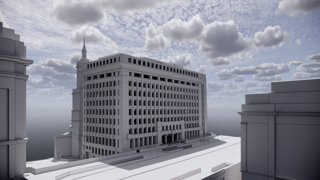
- The Adelaide House case study illustrates how detailed modelling—Crittall window types, tapered wall profiles and more—was delivered in a constrained, listed building context. A virtual tour anchored to that model would give heritage bodies and design teams intuitive access to those details.
These examples demonstrate how virtual tours, tied to precise models and scans, serve both design and communication purposes in demanding environments.
How Platinum 3D Delivers Tours That Truly Work
- Capture: We coordinate scanning and tour capture simultaneously to avoid duplication.
- Processing: The imagery is processed in high resolution, aligned to the point cloud and survey data.
- Tagging & Annotation: We embed hotspots, labels and navigational links (such as MEP zones, structural elements, or points of interest).
- Alignment with BIM: The tour is aligned to the coordinate system of your Revit model so context and geometry match.
- Delivery & Integration: We deliver the tour in web‑accessible form and can embed it with documentation or link it to FM platforms.
This integrated workflow ensures the tour isn’t just a visual tool, but a functional reference in your design, review, and operations processes.
The True Value: Time, Precision, Confidence
Virtual tours deliver measurable returns:
- Reduced site visits and permit access costs
- Faster stakeholder engagement and decision cycles
- Fewer misunderstandings or scope change orders
- Better Safety planning through virtual walkthroughs
- A persistent visual documentation asset for handover or FM.
In complex or high-risk projects, that clarity is not optional—it’s essential.
Talk To Platinum 3D Consultants
When everybody can step into a site virtually, even before construction begins, misalignment, surprises and confusion shrink. Virtual tours anchored to real survey data become the visual thread tying clients, designers, regulators, contractors and facility teams together. At Platinum 3D Consultants, our strength lies in delivering tours that aren’t just pretty. They are precise, aligned, and optimised to drive smarter collaboration.
If you’re planning a new build, refurbishment or estate upgrade, let us show you how a virtual tour anchored in survey and BIM can transform your process and stakeholder engagement. Contact Platinum 3D Consultants today.