
Redeveloping an existing site—particularly one with a complex, layered history—requires far more than just planning permission and design ambition. Before any structure can be safely demolished or remodelled, developers need a detailed, accurate understanding of the site’s current condition. That’s where measured building surveys and laser scanning services come into their own.
At Platinum 3D Consultants, we specialise in capturing existing environments using the latest 3D laser scanning and measured survey technology. Our in-house team creates geometrically accurate 2D drawings and 3D Revit models that help developers make confident decisions, reduce risks, and optimise the redevelopment process from the outset.
The Demolition Dilemma: Why Accuracy Matters From Day One
Every redevelopment begins with the need to understand exactly what’s already there. Buildings constructed in previous decades often come with outdated or missing documentation. That’s a problem when it comes to managing demolition safely and efficiently—especially when parts of a structure will be retained or integrated into new developments.
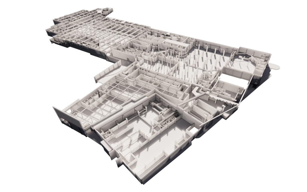
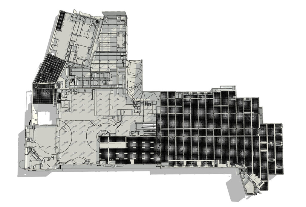
For example, in the case of Broadwalk Shopping Centre in Bristol, built in the 1970s and earmarked for redevelopment following years of decline, Platinum 3D Consultants were commissioned to conduct a full measured survey. This included the shopping centre itself, as well as attached structures like the bingo hall, snooker hall, basement levels, and car park.
The result? A set of 2D plans and a subsequent 3D Revit model of the basement—essential for coordinating the safe retention of this element in the new mixed-use scheme.
Laser Scanning: A Precise First Step in the Process
Laser scanning uses advanced LiDAR (Light Detection and Ranging) technology to collect millions of measurement points per second, creating a highly detailed “point cloud” of the site. This digital replica captures every architectural detail with millimetre precision—even in difficult-to-access or poorly documented areas.
Once captured, this data can be used to generate:
- 2D floor plans, elevations and sections
- 3D Revit or CAD models
- Area measurements for planning and commercial use
- Digital twins for analysis and coordination
What makes this approach ideal for demolition projects is that it eliminates guesswork. Developers and design teams can visualise every element of the structure—its load-bearing features, spatial constraints, and interfaces with retained areas—before any physical intervention begins.
The Benefits for Redevelopment Teams
In real terms, laser scanning and measured building surveys deliver a range of benefits for anyone involved in redeveloping an existing site:
1. Better Planning and Phasing
Demolition must be carefully phased, particularly when partial demolition is involved or surrounding areas remain in use. With a complete digital model of the building, contractors can plan each stage with confidence, knowing what materials and structures are present and how they interconnect.
2. Safety and Risk Reduction
Accurate building data allows health and safety risks to be assessed in advance. For example, identifying enclosed voids, unstable staircases or potentially hazardous ceiling materials before entry can significantly reduce on-site risks.
3. Clarity for Design Teams
When parts of a structure are to be retained, as with the basement level at Broadwalk, 3D modelling ensures these retained elements are precisely documented and can be accurately integrated into the new scheme.
This avoids costly errors caused by misalignments, spatial conflicts or outdated information.
4. Remote Collaboration
Laser scanning data and Revit models can be shared digitally with architects, structural engineers, planners and contractors—wherever they are. This improves collaboration and reduces the need for multiple site visits, especially useful when site access is limited or regulated.
5. Adaptability and Future-Proofing
Laser scan data can be revisited at any point. In the Broadwalk example, once the client decided they needed a 3D model of the basement area after the initial delivery of 2D plans, Platinum 3D were able to generate it without needing to return to site. That’s the benefit of full scan coverage.
Who Benefits from These Services?
These insights aren’t just relevant to architects. A full measured survey can help:
- Developers plan efficiently, manage risk and gain faster approvals.
- Contractors prepare accurate construction and demolition sequencing.
- Planners assess visual impact and compliance with local policy.
- Heritage consultants record historically significant elements before removal.
- Facility managers understand how retained areas will connect to new builds.
From Site Survey to Smart Redevelopment
As demolition and redevelopment projects become more ambitious and integrated, the need for precise digital representations of existing sites is growing. Whether the end goal is a residential community, commercial hub, or mixed-use complex, getting the early data right is crucial.
At Platinum 3D Consultants, our laser scanning, measured survey and Revit modelling services give project teams the tools they need to build on solid digital foundations. With extensive experience in complex redevelopment sites, including shopping centres, heritage buildings, industrial structures and public infrastructure, we are trusted by clients across the UK to deliver accurate, dependable models that streamline even the most challenging projects.
Get in Touch
If you’re planning a demolition or redevelopment project, our expert team is here to help. Contact Platinum 3D Consultants to discuss how our measured surveys, 3D models, and BIM-ready data can transform your approach and reduce costly surprises further down the line.