
Every successful building project starts with one thing: trust in the data. Whether it’s an ambitious heritage refurbishment, a new development in a constrained city centre, or a large public sector estate, everyone involved — from the architect and contractor to the facilities manager — relies on knowing that the information they’re working with is accurate, consistent, and up to date.
At Platinum 3D Consultants, that confidence begins with precise, site-verified data captured through advanced 3D laser scanning, and continues all the way through to BIM coordination, Revit modelling, and Matterport virtual tours. The result is a seamless digital workflow that reduces risk, improves communication, and helps every stakeholder make better, faster decisions.

Why Every Project Starts with Accurate Reality Capture
The foundation of any reliable digital model is reality capture — a complete, measurable record of how a site actually exists today. Platinum 3D uses high-performance Leica laser scanners to record millions of data points per second, creating dense point clouds that document every wall, column, beam, and surface with millimetre-level precision.
This non-intrusive process is far quicker and safer than traditional measurement methods, especially in complex or high-risk environments such as operational hospitals, heritage buildings, or busy commercial sites. Each scan becomes part of an integrated dataset that forms the foundation for accurate measured building surveys, BIM-ready Revit models, and Matterport 3D virtual tours.
Because the scans are geo-referenced, every piece of information aligns perfectly within the same coordinate system — an essential feature when working across large campuses or multi-building sites. That accuracy allows design teams and contractors to start from a shared, verified baseline rather than a mix of outdated drawings or assumptions.
How Revit Models and Matterport Tours Make Data Accessible to Everyone
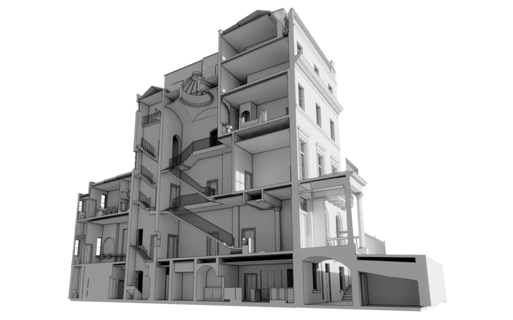
Once captured, the laser-scanned data is converted into intelligent Revit models that include detailed structural and architectural elements — all modelled to an agreed Level of Detail (LOD) such as LOD 3 for design coordination or LOD 2 for context and planning.
These models aren’t just digital replicas; they’re tools for collaboration. Architects, engineers, contractors, and facilities managers can interrogate the same model in real time, ensuring that everyone works from a single source of truth. Any clashes or inconsistencies are identified before construction begins, dramatically reducing the risk of costly rework.
For non-technical stakeholders such as clients, heritage trusts or public sector teams, Matterport virtual tours make the data instantly accessible. These immersive walkthroughs allow users to explore the site remotely, with the ability to tag elements, add comments, and share insights between disciplines. For complex refurbishments or constrained sites, this visibility removes the need for repeated physical site visits, improving efficiency and safety while strengthening shared understanding across the project team.
The Importance of Verified Geometry for Planning and Design Approvals
In today’s construction and development environment, planners and design reviewers expect projects to be based on verified, measurable data. Inaccurate drawings or assumptions about existing conditions can lead to significant delays or even planning refusals.
Platinum 3D’s laser scanning and Scan to BIM workflow ensures that every measurement is backed by real-world evidence. This is especially valuable when working on heritage and conservation projects, where preserving original detail is essential. Accurate geometry enables design proposals to demonstrate respect for the existing fabric while meeting modern performance standards.
A geo-referenced BIM model also provides the transparency required for compliance documentation, sustainability assessments, and digital handovers — all of which are becoming standard expectations for both private and public sector projects.
Real-World Insights: Avoiding Rework in Complex Refurbishments
In complex renovation environments, even a small measurement error can cascade into major problems later on. One example is the Adelaide House project near London Bridge, where Platinum 3D provided a comprehensive laser scan survey and produced an LOD 3 Revit model of the Grade II listed building.
Because the model was built directly from verified scan data, it captured challenging elements such as tapered exterior walls and intricate Crittall window profiles with precision. This level of accuracy enabled the design and construction teams to plan confidently, avoiding rework and minimising disruption to the building’s historic façade.
Another example is the London Metropolitan University estate, where 17 buildings were scanned and modelled to create a fully geo-referenced campus model. The data is now used by both architects and facilities managers, ensuring that refurbishment and maintenance decisions are based on reliable, up-to-date information.
These projects demonstrate how Platinum 3D’s integrated workflow — from laser scanning to Revit and Matterport — not only supports design and planning but also adds value throughout the building’s lifecycle.
Long-Term Advantages for FM and Lifecycle Asset Management
Once a project is complete, the value of accurate 3D information continues long into the operational phase. Facilities managers and estate teams can use Platinum 3D’s BIM-ready models and Matterport tours for space management, maintenance planning, and future refurbishment work.
Because every component and system is digitally documented, maintenance teams can visualise assets in context, track performance data, and plan upgrades without repeated on-site inspections. Over time, this leads to better budgeting, improved sustainability outcomes, and fewer unexpected issues.
For public institutions, universities, and heritage organisations managing complex estates, the ability to maintain a reliable digital record of every space is a major step toward smarter, data-driven management.
Who Benefits from Accurate 3D Information
- Design Teams: Gain accurate base data for feasibility, design, and coordination
- Contractors: Reduce risk and rework by building from verified geometry
- Public Sector Clients: Ensure compliance, accountability, and cost efficiency
- Heritage Trusts: Preserve architectural integrity with precision-based planning
- Facilities Managers: Use BIM data and Matterport tours to manage assets efficiently
From capture to collaboration, Platinum 3D’s services create a shared language of accuracy that brings transparency and trust to every stage of a project.
Building Confidence Through Data You Can Trust
In an industry where assumptions can cost thousands, verified 3D information has become indispensable. Platinum 3D Consultants’ end-to-end process — from laser scanning and measured building surveys to BIM coordination and Matterport visualisation — gives project teams the confidence to collaborate, design, and deliver with certainty.
To learn how accurate 3D data can reduce risk and improve outcomes on your next project, contact Platinum 3D Consultants today.