
Modern construction, refurbishment and heritage projects demand reliable, high‑fidelity data. Today, laser scanning (also known as 3D laser scanning or LiDAR) is a cornerstone of measured building surveys, providing accuracy, efficiency, and confidence far beyond conventional methods. At Platinum 3D Consultants, we’ve been working with point clouds and laser scanners since 2002, continually investing in state‑of‑the‑art scanners and software. Here’s how it works, why it’s so accurate, and why clients across the built environment rely on it.
How Laser Scanning Works: From Light to Point Cloud to Model
Laser Emission & Time-of-Flight / Phase-Shift Capture
A laser scanner emits pulses of infrared or near-infrared light across its surroundings. The pulses bounce off surfaces and return to the scanner. Using the time it takes for the light to return (Time‑of‑Flight method) or measuring the phase shift (Phase‑Shift scanners), the device computes the precise distance to each point. Over millions of pulses per second, it builds a highly dense dataset of XYZ coordinates known as a point cloud.

Dense Point Cloud Creation
Each laser pulse that returns gives a single point in space. By sweeping across a full 360° horizontally and often near‑full vertical coverage, the scanner generates millions (or even hundreds of millions) of points in seconds. These points collectively represent the shape and features of the scanned space in incredible detail. Some high-end scanners capture up to 1 million points per second or more.
Registration, Cleaning & Processing
Multiple scans from different positions are required to capture all surfaces (including occluded ones). These scans are aligned or “registered” through overlapping geometry or control markers. The combined, cleaned-up point cloud is free from noise or stray points, and is usually geo‑referenced into a common coordinate system so it aligns properly with maps, boundaries or external data.
From Point Cloud to Usable Deliverables
Once processed, the cloud becomes the base for extracting 2D plans, elevations and sections. More powerfully, it feeds into Scan-to-BIM workflows: modelling the data into Revit or other BIM platforms at required levels of detail (e.g. LOD2, LOD3). This creates parametric, editable models grounded in real measurements.
Why Laser Scanning Offers Unmatched Accuracy
Millimetre-Level Precision
Professional laser scanners are capable of extremely fine resolution and repeatability. Under controlled conditions, error margins can be within a few millimetres over tens of metres. That level of accuracy surpasses typical manual measurement methods (tape, disto, total station) especially in complex geometries. Platinum 3D highlights this in their discussion of accuracy expectations of measured building surveys using laser scanning.
Capturing Complex & Irregular Features
Curved walls, uneven surfaces, angled features, cornices, mouldings and hidden recesses are difficult to measure by hand reliably. Laser scanning captures every subtle bend or warp. For instance, in heritage façades or older buildings with shifts over time, this fidelity is critical.
Minimising Human Error & Oversights
Manual methods rely heavily on operator skill, line-of-sight, and spot checks. Errors and mis‑interpretations accumulate. Laser scanning, in contrast, captures continuous data across surfaces, leaving fewer gaps or assumptions.
Non-Contact & Safe Capture
Because the scanner doesn’t need physical contact, fragile surfaces or difficult-to-reach areas (high ceilings, behind plant, tight corridors) can be documented safely. Surveyors can avoid disturbance or risk while still getting full coverage.
Single Full Dataset for Multiple Uses
Once scanned, the same data can be reused. If later phases require revisiting a space, there’s often no need to return physically—measurements can be extracted later from the point cloud. This drastically reduces return visits and site rework.
Measured Building Surveys with Laser Scanning vs Traditional Techniques
| Feature | Traditional Survey (Tape, Disto, Total Station) | Laser Scanning / Measured Survey |
|---|---|---|
| Speed on site | Slower, many manual setups | Fast wide coverage in fewer setups |
| Completeness | Spot checks, may miss features | Dense coverage, minimal gaps |
| Irregular geometry | Hard to capture subtle deformations | Captures full curvature and detail |
| Rework / Revisits | Often needed if something is missed | Rarely needed—data is comprehensive |
| Safety in tight zones | Risk for surveyors | Non-contact capture reduces risk |
| Integration with BIM | Requires manual drafting | Direct Scan-to-BIM workflow |
Compared to older methods, the superiority of laser scanning emerges when complexity, geometry, or data reuse matter.
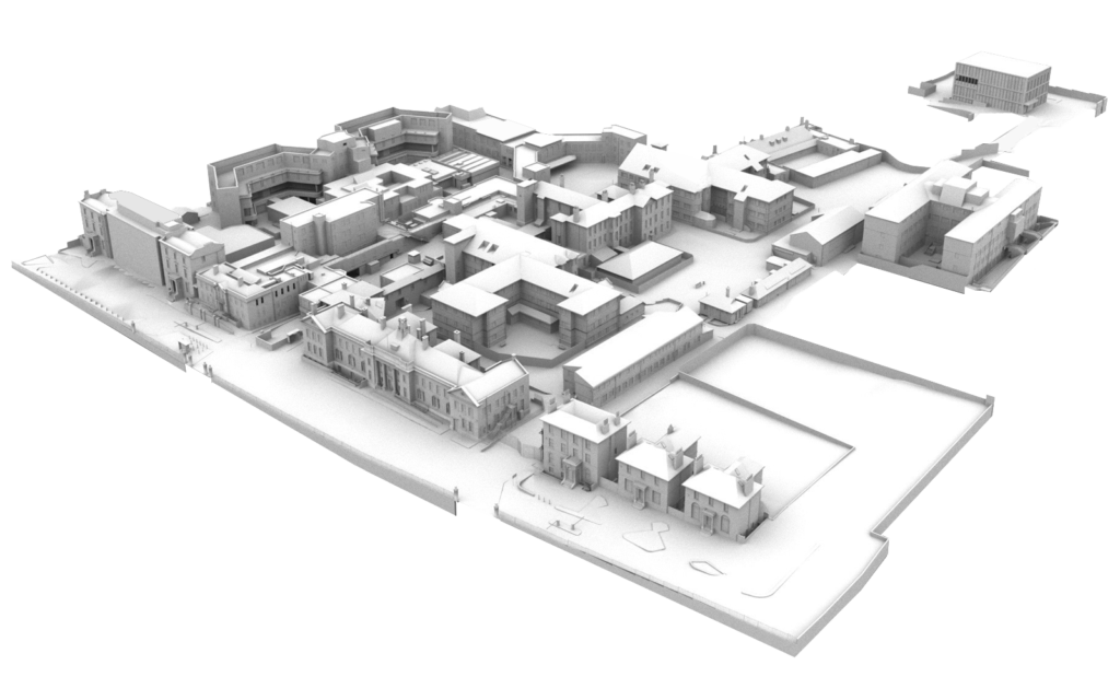
Benefits of Laser-Driven Measured Building Surveys: Who Gains & Why
Architects & Designers
Accurate existing conditions data means design decisions rest on fact, not guesswork. Changes to existing structures, junctions, and interfaces are easier to validate. Complex retrofits or infills become more feasible.
Engineers & MEP / Structural Teams
Clash detection, structural analysis and coordination of mechanical runs all benefit from highly precise models. Laser-scanned models reduce the risks of interference and misalignment.
Contractors & Fabricators
Prefabrication of components with confidence is enabled when dimensions are solid. Avoiding mismatches on site saves time, cost, and disruption.
Developers & Clients
Estimations, risk assessment, and planning become more reliable. Surprises in hidden areas are fewer and less costly. Clients gain a digital asset for future use.
Facility Managers & Owners
The as-built model becomes an invaluable reference for ongoing maintenance, space planning, and future modifications.
Heritage & Conservation Teams
Historic buildings demand non-invasive measurement and exact documentation of original fabric. Laser scanning supports sensitive restoration whilst preserving authenticity.
Platinum 3D’s service emphasizes that measured building surveys generate not just 2D plans but rich 3D models and point clouds that benefit all these stakeholders from day one.
Real-World Examples from Platinum 3D
- Accuracy Expectation — The article “What Level of Accuracy Can You Expect From a Measured Building Survey Using Laser Scanning and Why” outlines how Platinum 3D achieves high precision in real projects.
- Project Delivery & Capability — On the main site, Platinum 3D promises “precise 3D laser scanning and surveying services tailored to your project, ensuring accuracy and efficiency.”
- Complex Heritage & Facade Projects — In projects such as Adelaide House (London Bridge) and the Natural History Museum (labs and plant rooms), the complexity of geometry, plant, and heritage detail demands laser-driven modelling (as seen across their case studies). While those case studies focus more broadly, the technological backbone is scanning + BIM.
When Laser Scanning Truly Makes the Difference
In fact, it becomes essential in scenarios like these, where its precision and completeness offer unique value
- Heritage or listed buildings with irregular features
- Sites lacking up-to-date or reliable drawings
- Tight, constrained, or cluttered interiors (plant rooms, infrastructure)
- Projects needing later-phase additions or phased delivery
- Environments with safety, height or access constraints
- Multi-phase or campus works needing consistency and reusability
In these contexts, laser scanning doesn’t just help—it becomes foundational.
Precision That Powers Confidence
Laser scanning elevates measured building surveys from guesswork to certainty. Its non-contact, highly accurate, richly detailed capture delivers benefits across design, construction, operation and conservation. At Platinum 3D Consultants, we’ve integrated this precision into every project for over two decades, combining point clouds, BIM modelling, and tailored deliverables so our clients can act with clarity, avoid costly surprises, and get things right first time.
If your project demands a reliable, digitally grounded as-built record, reach out to Platinum 3D Consulting today. Let us show you how scanning-first surveying makes all the difference.